|
|
|
| Maps > Asia > China |
Historic and contemporary maps of China including political, physical, cultural, relief, empirical and colonial maps.
|
Lhasa Tibet,
1912 |
|
The Great Powers and Imperialism in China,
1919 |

|
Canton and Hong Kong,
1919 |
|
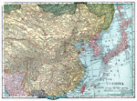
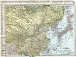
China,
1920 |

|
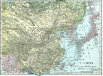
China,
1920 |
|
China,
1920 |
|
China,
1920 |
|
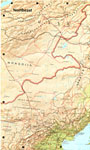
Northeast China,
1971 |
|
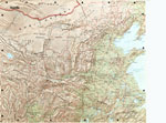
North China,
1971 |
|
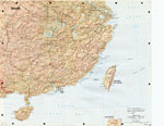
South China,
1971 |
| First | Previous | Next | Last |
| Maps > Asia > China |
Maps ETC is a part of the Educational Technology Clearinghouse
Produced by the Florida Center for Instructional Technology © 2009
College of Education, University of South Florida