|
|
|
| Maps > Europe > Spain |
Historic and contemporary maps of Spain, including battle plans, for use in the K-12 classroom.

|
Territorial Growth of Spain,
1230–1580 |
|
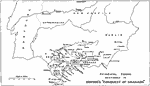
Principal Towns Mentioned in Irving's "Conquest of Granada",
1492 |

|
Spanish Kingdoms,
1513 |
|
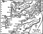
Vigo Bay,
1919 |
|
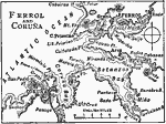
Ferrol and Coruna,
1919 |
|
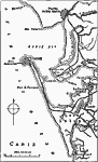
Cadiz,
1919 |
|
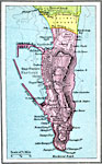
Gibraltar,
1920 |
|
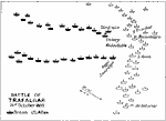
Battle of Trafalgar,
October 21, 1805 |
|
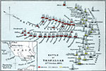
Battle of Trafalgar,
October 21, 1805 |
| Maps > Europe > Spain |
Maps ETC is a part of the Educational Technology Clearinghouse
Produced by the Florida Center for Instructional Technology © 2009
College of Education, University of South Florida