|
|
|
| Maps > North America > Canada |
Historic and contemporary maps of Canada including physical and political maps of provinces and territories, early exploration and settlement, climate, vegetation, battle plans, geomorphic, and automobile route maps.
|
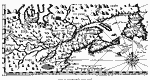
Part of Champlain's Map,
1613 |
|
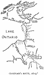
Champlain's Route,
1615 |
|
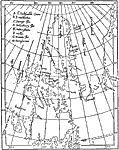
Baffin's Bay,
1635 |
|
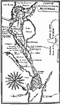
Montreal and Vicinity,
1665 |
|
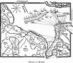
Attack on Quebec,
1690 |
|
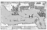
Attack on Quebec,
1690 |
|
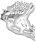
Quebec,
1700s |
|
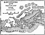
Louisburg and Vicinity,
1745 |
|
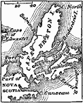
Cape Breton,
1745 |
|
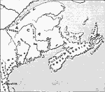
Acadia,
1758 |
| First | Previous | Next | Last |
| Maps > North America > Canada |
Maps ETC is a part of the Educational Technology Clearinghouse
Produced by the Florida Center for Instructional Technology © 2009
College of Education, University of South Florida