Maps Site map
  Maps > United States > Ohio
Site Map  

  Record   31   to   37  of   37

A collection of historic and contemporary political and physical maps of Ohio, including early history, and significant archeological sites.
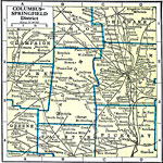
Columbus–Springfield District, 1920
A map from 1920 of the Columbus and Springfield district of Ohio showing counties and county seats, principal cities and towns, railroads, canals, and rivers....

Ohio, 1920
A map from 1920 of Ohio showing the capital of Columbus, counties and county seats, principal cities and towns, railroads, canals, lakes, and rivers....

Cleveland and Toledo District, 1920
A map from 1920 of the Cleveland Toledo district, showing counties and county seats, principal cities and towns, railroads, and islands of Lake Erie. ...

Cincinnati and Vicinity, 1922
A map from 1922 of Cincinnati and its vicinity showing neighboring counties, cities and towns, railroads, canal, and rivers. ...

Ohio, 1922
A map from 1922 of Ohio showing the capital of Columbus, principal cities and towns, railroads, canals, lakes, and rivers....

Cleveland and Vicinity, 1922
A map from 1922 of Cleveland and vicinity showing neighboring counties, cities and towns, railroads, canals, and rivers....

The State of Ohio, January 1804
After the French and Indian War, France ceded control of the Northwest region including Ohio to Great Britain. With American independence, Ohio became a part of the Northwest Territory, the first organized land addition to the original thirteen colon...

First Previous


  Maps > United States > Ohio
Site Map  

Maps ETC is a part of the Educational Technology Clearinghouse
Produced by the Florida Center for Instructional Technology © 2009
College of Education, University of South Florida