|
|
|
| Maps > United States > Regional Maps >Northeast States |
|
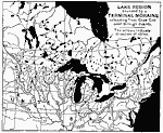
Great Lake Region Bounded by a Terminal Moraine,
1888 |
|
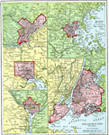
Atlantic Seaports,
1901 |
|
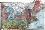
The Northeast United States,
1903 |
|
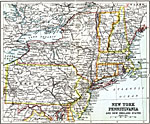
New York, Pennsylvania, and New England States,
1911 |
| Maps > United States > Regional Maps >Northeast States |
Maps
is a part of the
Educational Technology Clearinghouse
Produced by the
Florida Center for Instructional Technology
© 2009
College of Education
,
University of South Florida