Oriskany
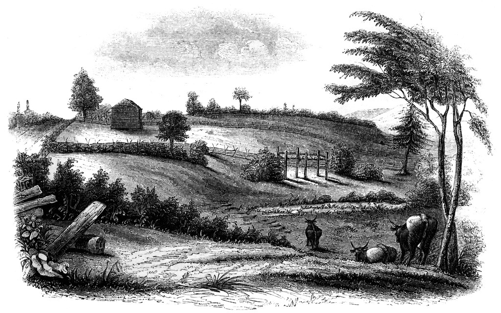
The battle-ground of Oriskany. This sketch was made from the eastern side of the ravine, looking west. The marsh in the bottom of the ravine, mentioned in the text, is partially drained by a rivulet. When I visited the spot (August, 1848), many logs of the old causeway were still visible, and afforded a crossing-place for cattle. These logs are seen in the picture. The road on the left is the present highway between Oriskany and Rome. The barn stands upon the road southeasterly, the ambush was placed. The hottest of the battle occurred upon the high plain between the ravine is the foreground and another beyond the most distant trees in the picture. The hills seen in the xtreme distance, on the right, are those upon the north side of the Mohawk. The frame-work in the ravine is the remains of the scaffolding erected for the speakers at the celebration alluded to, in 1844.
Galleries
1763-1788 American Revolution PlacesSource
Benson J. Lossing, The Pictorial Field-Book of the Revolution (New York: Harper & Brothers, 1851)I:245
Downloads
2400×1502, 3.5 MiB
1024×640, 295.9 KiB
640×400, 117.3 KiB
320×200, 29.9 KiB