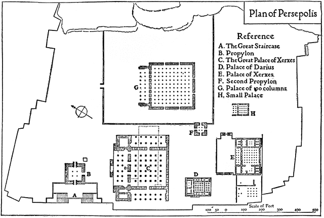
Plan of Persepolis, 513 BC
To use any of the clipart images above (including the thumbnail image in the top left corner), just click and drag the picture to your desktop. You may also control-click (Mac) or right-click (Windows) and choose "Save file to disk" from the pop-up menu. Click here for help downloading and using clipart files.
* A TIFF file is a high-resolution (240 dpi) format. TIFF files should be used only if you are printing the clipart. Do NOT use TIFF files for clipart that will displayed on a computer screen. Click here for help downloading and using TIFF files.File Name: 73423_persepolis
Description: 
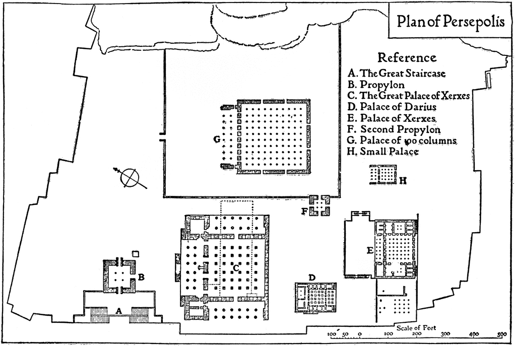
A plan of Persepolis, near Shiraz, Iran, from the time of Darius I (549–486 BC) until the downfall of the Achaemenid dynasty (330 BC). This is an example of Persian architecture of the time. "The plan shows the general configuration of the platform on which the palaces of Persepolis are built, which covered an area of about1,600,000 sq. ft. The principal approach to it was at the north–west end." — The Enctclopædia Britannica, a Dictionary of Arts, Sciences, Literature and General Information, 1910.
Source: Encyclopaedia Britannica (11th ed.) (New York: The Encyclopaedia Britannica Company, 1910) 2:376
Keywords: Persian architecture, floor plan
Copyright: 2009, Florida Center for Instructional Technology. See license.
Main Menu Site Map Search License Clipart Help
Clipart ETC is a part of the Educational Technology Clearinghouse and is funded by various grants. Produced by the Florida Center for Instructional Technology, College of Education, University of South Florida. Email the project manager.