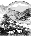
Valleys
The Valleys ClipArt gallery provides 23 illustrations of low areas of land, usually between hills or maintains. These depressions are typically formed by a river or glacier. Other names for valleys include dales, dells, glens, ravines, gorges, gullies, or hollows.
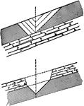
Anticline
This illustration shows a perspective view and a vertical section of an anticline. It shows the half-cigar-shaped…
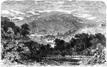
Cumberland Gap
"Cumberland Gap and Heights, Tenn., from the Kentucky side. Cumberland Gap was a place of such importance…
Cavalry of General Banks
"A reconnoitring detachment of General Banks's cavalry, Hyattstown, Md., in the distance. There are…
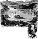
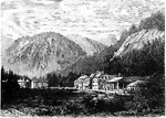
Hot Springs, Arkanasas
An view of Hot Springs, Arkansas which is nestled in a valley between two mountains. Hot Springs is…
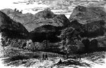
Landscape
An illustration of a man standing on a ledge of Lookout Mountain looking over a valley. Lookout Mountain,…
Loudon Heights
"View from Loudon Heights, Va., showing Harper's Ferry, Maryland Heights, Bolivar, etc. Harper's Ferry,…
Oatka and Dale Valleys
Diagram showing the junction of the Oatka and Dale Valleys near Warsaw. The Dale is a hanging valley…
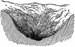
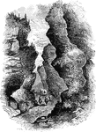
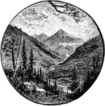
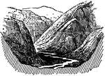
Wimbach Ravine
The Wimbach ravine resides at the entrance of the Wimbach valley, one of the 3 main valleys of the national…
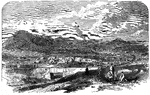
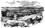
View of Strasburg
"View of the town of Strasburg, valley of the Shenandoah, occupied by the Federal forces under General…
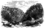
Thoroughfare Gap
"Thoroughfare Gap, Va., a pass in the mountains on the Manassas Gap Railroad, near Strasburg, held by…
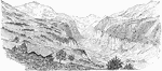
Valley
If land falls to a minimum line with a steady slope, the land form created is called a valley.
Valley
An image of what a regular valley would look like if it were cut to make a plateau and lowlands.
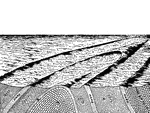
Valley Development
"By downward corrasion a stream cuts a steep-sided trench of its own width, but weathering, gravitation,…
Usymmetrical Valley Development
"If the strata are not horizontal, various unsymmetrical forms are produced." -Dryer, 1901
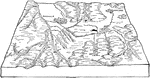
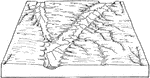
Wayland Valleys
Diagram illustrating the relation of the Dansville to the Wayland Valleys. The floor of the Wayland…
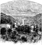
Wilbad Kreuth
Wilbad Kreuth is a quiet little town located in the mountains of Bavaria. Early in the sixteenth century,…
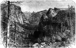
The Yosemite Valley, from Artist Point
Yosemite Valley is a world-famous scenic location in the Sierra Nevada mountains of California. It is…