Wetlands
The wetland ClipArt gallery includes 16 drawings of swamps, marshes, bogs, and and other land areas saturated with water. The primary factor that distinguishes wetlands from other land forms or water bodies is the characteristic vegetation of aquatic plants, adapted to the unique hydric soil.
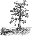
Bald Cypress in Swamp Form
An image of a bald cypress in swamp form, with aerating roots, or knees. It is otherwise known as taxodium…
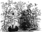
Everglades
The Everglades is a subtropical wetland located in the southern portion of the U.S. state of Florida,…
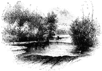
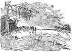
The Isle of Athelney
Athelney is located between the villages of Burrowbridge and East Lyng in the Sedgemoor district of…
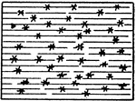
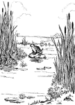
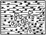
Fresh Marsh
The typical representation of a marsh in general (or fresh marsh) on a topographical map.
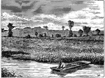
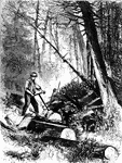
Rice Swamp
The rice fields are confined to low, flat, marshy tracts, near the coast or river bottoms.
Buried Swamp
Ancient cedar trees were found buried beneath the Dennisvill swamp in southern New Jersey. It was believed…
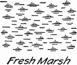
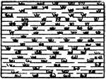
Fresh Water Marsh Topography Symbol
Topography map symbol for fresh water marsh used in drafting and map drawing.
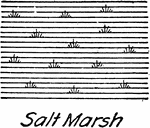
Salt Water Marsh Topography Symbol
A conventional topographical water feature for salt water marsh used in drafting and map drawing.
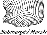
Submerged Marsh Topography Symbol
Conventional topography symbol for submerged marsh used in drafting and map drawing.