The 1763-1788 American Revolution Places ClipArt gallery provides 303 illustrations of the Apollo Room, Carpenter's Hall, Concord, Faneuil Hall, Mount Vernon, the Old South Meeting House, and other locations associated with the American War for Independence.
Howe's Headquarters
"When Howe reached that place he found General Sullivan confronting him, and the fishermen of Marblehead,…
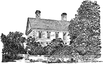
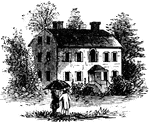
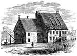
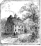
Howe's Quarters
"General Howe's quarters were in a house on High Street, one door east from the southeast corner of…
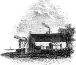
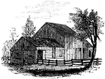
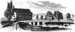
Hubbard's House and Mill
"Hubbard's House and Mill. The inscriptions upon the monument are as follows: East Side: "Oliver Hazard…
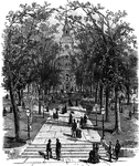
Independence Hall, Philadelphia
Indepenence Hall, Philidelphia, where the Declaration of Indepence was signed.
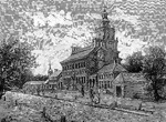
Independence Hall
The location where both the Declaration of Independence and the United States Constitution were debated…
Jacob Purdy House
The Jacob Purdy House was used as General George Washington's headquarters in 1778 and possibly in 1776…

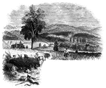
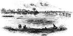
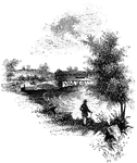
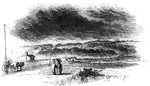
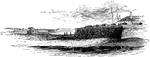
James River
"Scene on the James River, at Richmond. This view is from a long shaded island extending up the river…
Jameson's Head-quarters
"Colonel Jameson's head-quarters. This is a view of the out-buildings of Mr. Sands, at North Castle,…
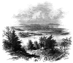
Jamestown Island
"Distant view of Jamestown Island. This view is from the north side of what was once a marsh, but now…
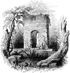
Jamestown Ruins
"Ruins at Jamestown. This view is from the old church-yard, looking toward James River, a glimpse of…
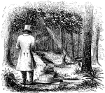
Jefferis' Ford
"View at Jefferis' Ford. This view is from the easterly bank of the Brandywine. The ford was at the…
Jumel Mansion
The Jumel Mansion in New York City is a historic location which served as the headquarters for both…
King's Bridge
"View at King's Bridge. This view is from the southwest side of the stream, from near the tide-mill.…
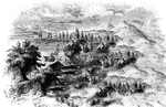
King's Mountain Battle-Ground
"View at King's Mountain battle-ground. This view is from the foot of the hill, whereon the hottest…
View at King's Mountain Battleground
The Battle of Kings Mountain, October 7, 1780, was an important Patriot victory in the Southern campaign…
Jacobus Kip's House
"Mr. Jacobus Kip lived in an old-fashioned Dutch house, built of bricks make in Holland and brought…
Lafayette's Headquarters Near Chadd's Ford
This is the place near Chadd's Ford where Lafayette took post and occupied his headquarters.
Liberty Hall
Liberty Hall. Some time after the death of Governor Livingston this property was purchased by Lord Blingbroke,…
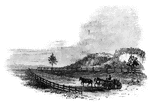
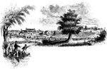
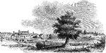
Little Falls
View at Little Falls. This view was taken from the rail-road near the village, looking down the river.…
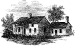
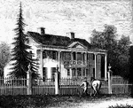
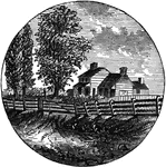
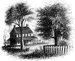
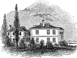
Livingston Mansion
The Livingston Mansion. Colonel Livingston died June 9th, 1849. Although living in the retirement of…
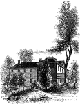
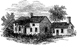
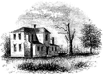
Livingston Mansion
"The Livingston Mansion. This is a view from the lawn on the north side. It is embowerd in trees and…
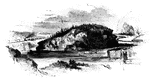
Long Point
Long Point and vicinity. This little sketch was taken from the steam-boat , near the south end of Long…
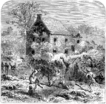
Lord Stirling's Last Stand Around the Cortelyou House
At the Battle of Long Island, in August of 1776, Stirling led the 1st Maryland Regiment in repeated…
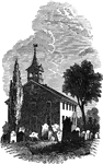
Lutheran Church, Barren Hill, Lafayette's Headquarters
This is the Lutheran Church in Barren Hill where Lafayette took post and occupied his headquarters.
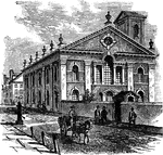
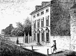
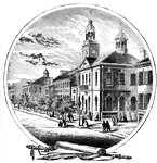
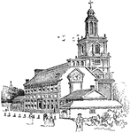
Lutheran Church, Philadelphia
The Lutheran Church in Philadelphia that Congress met at to "return thanks to the Almighty God for crowning…
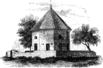
Old Magazine
"The Old Magazine. This view is from the square, looking southeast. South of it is a neat frame building,…
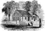
McIntosh's House
"Dwelling of General McIntosh. This house is the third eastward from Drayton Street, and is said to…
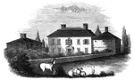
Milford Hill
West Bridge and Milford Hill. This view is from the Milford Road, eastward of West Bridge. The high…
Monmouth Battle-Ground
"Battle-ground at Monmouth. This view is from the orchard, upon the site of Wayne's position when Monckton…
Old Monmouth Courthouse
The Battle of Monmouth was an American Revolutionary War battle fought on June 28, 1778 in New Jersey.…
Battleground at Monmouth
The Battle of Monmouth was an American Revolutionary War battle fought on June 28, 1778 in New Jersey.
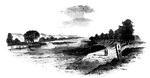
Monocasy Island
The Susquehanna at Monocasy Island. This view is from the left of eastern bank of the Susquehanna, opposite…

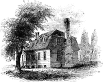
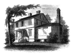
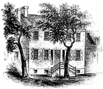
Moore's House
"This is a view from the lawn, looking south. It is a frame building with a brick foundation. At the…
Morris-Jumel Mansion
The Morris-Jumel Mansion, located in historic Washington Heights, is the oldest house in Manhattan.…
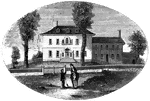
Morristown
Washington's head-quarters at Morristown. This view is from the forks of the road, directly in front…
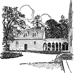
Morven
"Morven, Stockton's estate. This sketch is from the lawn in front, which is shaded by venerable pines…
Fort Moultrie
"View at Fort Moultrie. This view is from the southwestern angle of Fort Sullivan, looking toward Jame's…
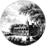
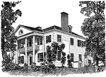
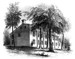
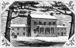
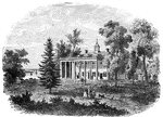
Mount Vernon
"Mount Vernon. This view is from the lawn in front, looking down the Potomac. The mansion is built of…

Mrs. Mathews' house
Mrs. Mathews' house. This sketch was made from the left bank of the Rahway, at the site of the old bridge.…
Neilson House on Bemis's Heights
The mansion of Neilson, an active Whig at the time of the Battle of Bemis's Heights. It was the headquarters…