The 1763-1788 American Revolution Places ClipArt gallery provides 303 illustrations of the Apollo Room, Carpenter's Hall, Concord, Faneuil Hall, Mount Vernon, the Old South Meeting House, and other locations associated with the American War for Independence.
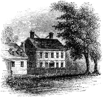
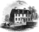
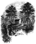
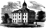
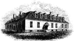
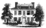
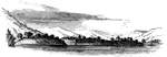
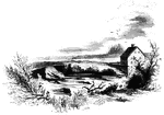
Nelson Mansion
"The Nelson Mansion. This view is from the street looking northwest. A long wooden building, with steep…
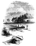
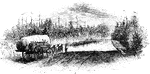
Nelson's Ferry
"View at Nelson's Ferry, the spot here portrayed, was an important locality during the Revolution. It…
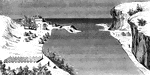
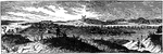
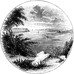
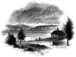
New London Harbor
"New London Harbor, looking north. This little sketch shows the relative position of the forts. Fort…
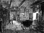
Interior of Washington's Headquarters at Newburgh
The interior of a room of General Washington's headquarters in Newburgh, New York.
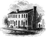
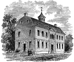
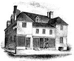
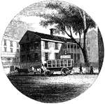
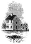
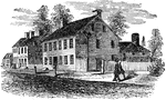
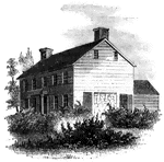
Old City Tavern
"Old City Tavern. This is a frame building, and stands on the northwest corner of Main and Nineteenth…
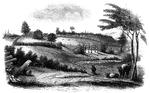
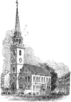
Old Parsonage and Church
Old Parsonage and Church. This view is from the high plain on the right of the block-house, looking…
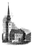
Old South
"The Old South. This venerable and venerated edifice, that stood through all the storms of the Revolution,…

Old South Meeting House
The Old South Meeting House in Boston, Mass. gained fame as the organizing point for the Boston Tea…
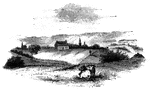
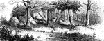
Oriskany
The battle-ground of Oriskany. This sketch was made from the eastern side of the ravine, looking west.…
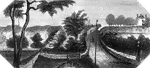
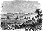
Oswego
Oswego in 1755. This view is looking north toward the lake. It is a reduced copy of the frontispiece…
Oswego Harbor
View of Oswego Harbor, 1848. This view is from the top of the United States Hotel, looking east-northeast.…
Peekskill Landing
"View from Peekskill Landing. This view is from Peekskill landing, looking up the river. On the left…
Penn's House
"Penn's House. This view is from Second Street. The building is of imported brick, except the modern…
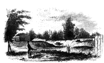
Plum Point
"Remains of fortifications at Plum Point. This view is from the interior of the redoubt looking eastward…
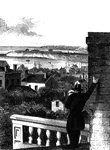
Point Levi
View of Point Levi from Durham Terrace, Quebec. This sketch is taken from Durham Terrace, near the north…
Prescott's Headquarters
"Prescott's Headquarters. This house is on the east side of the west road, about a mile from the bay.…
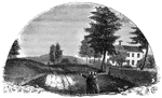
Princeton battle-ground
"View of the battle-ground near Princeton. This view, looking north, is from the carriage gate of Mr.…
Providence Tavern
"Old Tavern in Providence. This view is from the market, looking north. The building stands on the east…
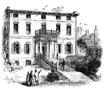
Province House
"The Province House. The Province House, the residence of the colonial governors, is still standing,…
Provost Jail
The New Jail was made a Provost Prison during the Revolutionary War and here officers and men of note…
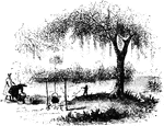
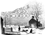
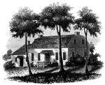
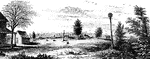
General Putnam's Land Office at Marietta
General Putnam's land office at Marietta during the American Revolution.

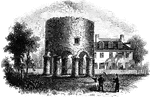
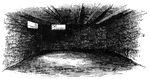
Fort Putnam
"Interior of Fort Putnam. This little sketch is a view of the remains of the casemates, or vaults, of…
Pyle's Pond
"Pyle's Pond. About a quarter of a mile northwest from this pond, is the spot where the battle occurred.…
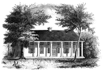
Raleigh Tavern
"Raleigh Tavern. When I visited Williamsburg in December, 1848, the front part of the old Raleigh tavern…
Rall's Headquarters
Johann Gottlieb Rall (ca. 1726 - December 26, 1776 ) was a German colonel in command of Hessian troops…
Ramapo Pass
"Remains of intrenchments the Ramapo Pass. This view is from the road, looking north toward the village…
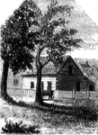
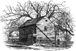
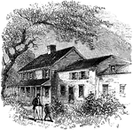
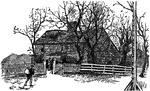
Red House
The Red House. The "Red House" is situated upon the street in Wilkesbarre next the river, and about…
Redoubt
"View from the site of the Redoubt. This view is from the mounds looking northwest, up the York River.…

Regulator Battle-ground
"The Regulator battle-ground. This view is from the south side of the Salisbury Road, which is marked…
Ridgefield
Place of the barricade, Ridgefield. This view is at the north end of the main street. It was taken from…
Riedesel House
"The Riedesel House, Cambridge. This is from a pencil sketch by Mr. Longfellow. I am also indebted to…
The Beverly Robinson House
The home of Beverly Robinson, a commander of the Loyal American Regiment. He is known for his work with…
Rocky Mount
"View at Rocky Mount. This view is from the garden-gate at Mrs. Barkley's, looking northeast. On the…
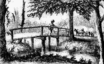
Rugeley's
"View at Rugeley's. This view is from the south side of the bridge. The counterfeit cannon was placed…
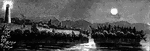
Sabbath Day Point
Sabbath Day Point. It is between three and four miles from the little village of Hague, in the midst…
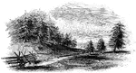
Sander's Creek
"View at Sander's Creek. This view is from the north side of the Creek. like the other stream, it is…
Saratoga and Stillwater - Encampments of Burgoyne's Army
Encampments of Burgoyne's army, Saratoga and Stillwater.
The Sayre House
The Sayre House in Southampton, New York which was occupied by the British during the Revolutionary…
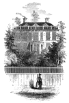
Schuyler's Mansion
Schuyler's Mansion. This view is from Schuyler Street. The edifice is of brick, having a closed octagonal…
Sholes's Landing
View from Shole's Landing. This is a view from Chipman's Point, or Sholes's Landing, looking north.…
Lake Sinnipink
"Lake Sinnipink, or Bloody Pond. This view is from the outlet of the lake, within a few rods of the…
Smith's House
"Smith's House. This view is from the slope in front of the house. The main building is of stone; the…
St. John's
Military establishment at St. John's. This view is taken from the eastern side of the river, near the…