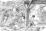
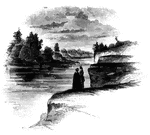
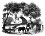
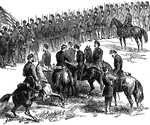
first interview
Site of the first interview between Gates and Burgoyne. This view is taken from the turnpike, looking…
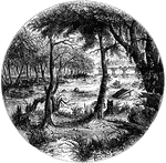
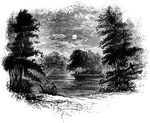
The Falls
View below the Falls. This view was taken from under the bridge, looking down the river. The cave opens…
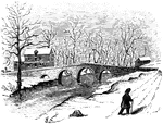
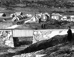
Fort Anne
Site of Fort Anne. This view is from the bridge which crosses Wood Creek, looking south. The distant…
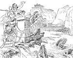
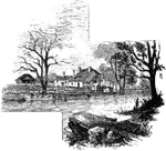
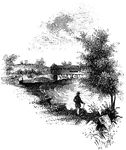
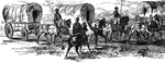
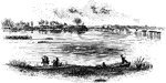
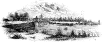
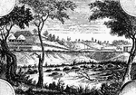
Chimney Point
Chimney Point Landing. This view is taken from the green in front of the inn at Chimney Point, looking…
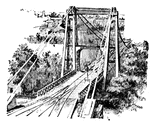
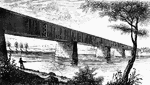
Niagra Bridge
Part of Niagra Suspension Bridge. This view, looking up from the river, comprises about one half the…
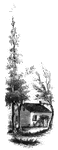
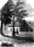
Mrs. Mathews' house
Mrs. Mathews' house. This sketch was made from the left bank of the Rahway, at the site of the old bridge.…
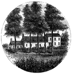
Steuben's Head-Quarters
Steuben's head-quarters. This view is from the field in front of the house, looking north. The dwelling…
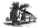
Red House
The Red House. The "Red House" is situated upon the street in Wilkesbarre next the river, and about…
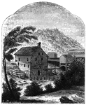
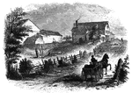
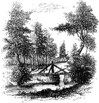
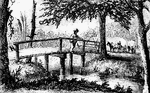
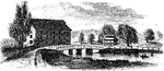
Van Schaick's Mill
Van Schaick's Mill. This view is taken from the left bank of the Walloomscoick, a little below the bridge.…
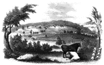
Bennington Battle-ground
The Bennington battle-ground. This view is from the hill on the southwest bank of the Walloomscoick,…
Agnew and Erskine
Head-quarters of Agnew and Erskine. This house is on the south bank of Still River, at the north end…
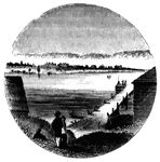
Fitch's Point
Fitch's Point, the landing-place of the British. This view is from the west side of Gregory's Point,…
Milford Hill
West Bridge and Milford Hill. This view is from the Milford Road, eastward of West Bridge. The high…
Barrett's House
"Colonel Barrett's House. This sketch is from the road leading to the village of Concord by the way…
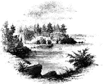
Williams landing-place
"Landing-place of Roger Williams. This view is on the left bank of the Seekonk, looking south. The point…
Greene and Knox Head-Quarters
"Head-quarters of Greene and Knox. This view is from the turnpike road, looking southeast. The water…
Sleepy Hollow
"Bridge over Sleepy Hollow Creek. Ichabod, according to Irving, in the Legend, returning from…
Trenton
"Trenton Bridge and vicinity. This view is from the north side of the Assanpink, a few rods above the…
Worth's Mills
"Bridge at Worth's Mill's. This substantial stone bridge, over Stony Brook, is upon the site of the…
Jefferis' Ford
"View at Jefferis' Ford. This view is from the easterly bank of the Brandywine. The ford was at the…
Chad's Ford
"View at Chad's Ford. This view is from the east bank of the Brandywine, looking southwest. The ford…
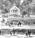
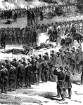
Battle at Willis Church
"Battle at Willis Church, Monday, June 30th, 1862- the Federal forces, under General Heintzelman, engaged…
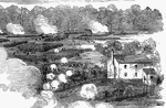
Bridge at Strasburg
"View of the town of Strasburg, valley of the Shenandoah, occupied by the Federal forces under General…
Old Church
"Desperate skirmish at Old Church, near Tunstall's Station, VA., between a squadron of the Fifth United…
Old Church
"Desperate skirmish at Old Church, near Tunstall's Station, VA., between a squadron of the Fifth United…
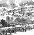
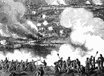
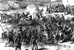
Battle of Malvern Hill
"Battle of Malvern Hill, near Turkey Bend, James River, Va., fought Tuesday, July 1st, 1862. The battle…
Battle of Malvern Hill
"Battle of Malvern Hill, near Turkey Bend, James River, Va., fought Tuesday, July 1st, 1862. The battle…
Battle of Malvern Hill
"Battle of Malvern Hill, near Turkey Bend, James River, Va., fought Tuesday, July 1st, 1862. The battle…
Battle of Malvern Hill
"Battle of Malvern Hill, near Turkey Bend, James River, Va., fought Tuesday, July 1st, 1862. The battle…
Battle of Malvern Hill
"Battle of Malvern Hill, near Turkey Bend, James River, Va., fought Tuesday, July 1st, 1862. The battle…
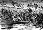
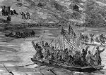
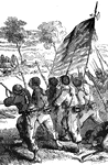
The Forlorn Hope
"'The Forlorn Hope.' Volunteers storming party, consisting of portions of the Seventh Michigan and Nineteenth…
The Forlorn Hope
"'The Forlorn Hope.' Volunteers storming party, consisting of portions of the Seventh Michigan and Nineteenth…
Battle of Antietam
"Battle of Antietam, Burnside's Division, left wing- brilliant and decisive bayonet charge of Hawkins's…
Battle of Antietam
"Battle of Antietam, Burnside's Division, left wing- brilliant and decisive bayonet charge of Hawkins's…
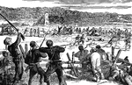
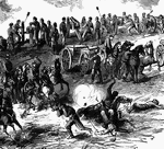
Battle of White Oak Swamp Bridge
"Battle of White Oak Swamp Bridge, Monday June 30th, 1862- Ayres's, Mott's and Randall's batteries checking…
Battle of White Oak Swamp Bridge
"Battle of White Oak Swamp Bridge, Monday June 30th, 1862- Ayres's, Mott's and Randall's batteries checking…
Battle of White Oak Swamp Bridge
"Battle of White Oak Swamp Bridge, Monday June 30th, 1862- Ayres's, Mott's and Randall's batteries checking…
Battle of White Oak Swamp Bridge
"Battle of White Oak Swamp Bridge, Monday June 30th, 1862- Ayres's, Mott's and Randall's batteries checking…
James River
"Scene on the James River, at Richmond. This view is from a long shaded island extending up the river…
Jamestown Island
"Distant view of Jamestown Island. This view is from the north side of what was once a marsh, but now…
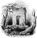
Jamestown Ruins
"Ruins at Jamestown. This view is from the old church-yard, looking toward James River, a glimpse of…
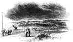
Trading Ford
"Trading Ford. This view of the Trading Ford, where greene, with Morgan and his light troops, crossed…
Rugeley's
"View at Rugeley's. This view is from the south side of the bridge. The counterfeit cannon was placed…
!["View from the site of Fort Cornwallis. Fort Cornwallis occupied the ground in the rear of the Episcopal church, now a grave-yard. This view is from within the inclosure, looking northeast, and includes a portion of Schultz's bridge, the Savannah River, and Hamburg upon the opposite bank. In the foreground is seen portions of the church-yard wall, and upon the brink of the river below are [African Americans] employed in placing bales of cotton upon the wharves for transportation to the sea-coast. The wharves are two stories in height, one to be used at low water, the other when the river is 'up.' There were remains of the ditch and embankments of the fort within the grave-yard when I was there; and the trench leading to the water-gate, where the 'Pride-of-India tree is seen, was very visible."—Lossing, 1851](https://etc.usf.edu/clipart/14100/14143/ft-cornwalli_14143_mth.gif)
Fort Cornwallis
"View from the site of Fort Cornwallis. Fort Cornwallis occupied the ground in the rear of the Episcopal…
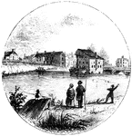
Turtle Bay
"View at Turtle Bay. Turtle Bay is a small rock-bound cove of the East River, at the foot of Forty-seventh…
Bronx
"Place where the British crossed the Bronx. This view is from the southeastern side of the Bronx, a…
King's Bridge
"View at King's Bridge. This view is from the southwest side of the stream, from near the tide-mill.…
Pons Cestius
"A bridge. As the rivers of Greece were small, and the use of the arch known to them only to a limited…
Pons Aelius
"A bridge. As the rivers of Greece were small, and the use of the arch known to them only to a limited…
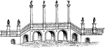
Pons Ariminum
"A bridge. As the rivers of Greece were small, and the use of the arch known to them only to a limited…
Pons Trajan
"A bridge. As the rivers of Greece were small, and the use of the arch known to them only to a limited…