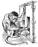
Monkey grabbing Gulliver
A monkey had ventured towards Gulliver's mini house. After discovering Gulliver, the monkey grabs him…
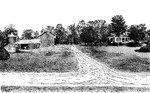
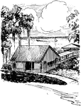
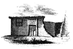
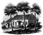
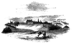
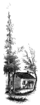
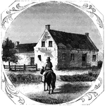
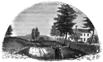
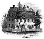
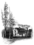
Farmhouse
A well-planted farmyard, with trees at the sides, flowers in the corners and about the house, and an…
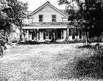
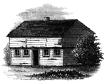
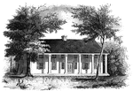
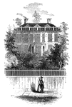
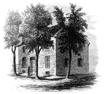
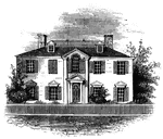
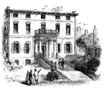
City House
A city house in the country. A low house would be better suited to sitting alone on a hill.
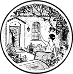
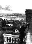
Couples waving
Two couples waiting at each other, one pair from the doorstep of a house, the other from an old convertable…
Rural residential area
Two figures play tennis across the road from a pair of sparsely distributed houses.
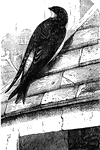
European House Martin
The European house-martin, which has an affinity for living in the vicinity of man.
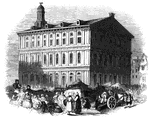
White House Landing
"White House Landing, Pamunkey River, Va., the Grand Depot of the Commissariat and Ordinance Department…
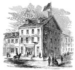
Marshall House
"The Marshall House, Alexandria, Va., where Colonel Ellsworth was assassinated by James W. Jackson,…
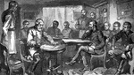
Terms of Surrender
"General Lee singing the Terms of Surrender at Appomattox court-house."—E. Benjamin Andrews 1895
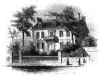
Pinzon Mansion
The Pinzon Mansion, the family, Martin Alonzo Pinzon and Vincent Yanez Pinzon commanded the Pinta…
Battle-ground
This view is taken from near the house of Mr. Neilson, looking northwest. In the foreground, on the…
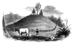
Fraser Burial
Fraser's burial-place. The hill on which the 'great redoubt' was erected, and where General Fraser was…
Fort Anne
Site of Fort Anne. This view is from the bridge which crosses Wood Creek, looking south. The distant…
St. John's
Military establishment at St. John's. This view is taken from the eastern side of the river, near the…
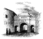
Palace Gate
Palace Gate, outside. This is one of the most beautiful gates of the city, and opens toward the St.…
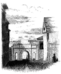
Palace Gate
Palace Gate, inside. This sketch is a view from within Palace Street, looking out upon the open country…
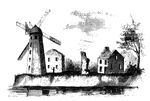
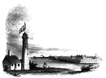
Wind-Mill Point
Wind-mill Point. This view was sketched from the steam-boat, when a little below the wind-mill, looking…
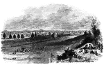
Oswego Harbor
View of Oswego Harbor, 1848. This view is from the top of the United States Hotel, looking east-northeast.…
Fort Niagra
Distant view of Fort Niagra. This view is from the west side of the Niagra River, near the light-house.…
Caughnawaga Church
Caughnawaga church. This old church, now (1848) known as the Fonda Academy, under the management…
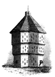
Fort Plain
Fort Plain block-house. There is considerable confusion in the accounts concerning Fort Plain, for which…
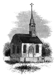
Old Parsonage and Church
Old Parsonage and Church. This view is from the high plain on the right of the block-house, looking…
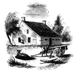
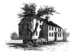
Butler House
The Butler House. John Butler was one of the leading Tories of Tyron county during the whole war of…
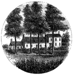
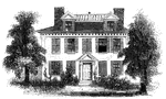
Schuyler's Mansion
Schuyler's Mansion. This view is from Schuyler Street. The edifice is of brick, having a closed octagonal…
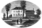
Morristown
Washington's head-quarters at Morristown. This view is from the forks of the road, directly in front…
Mrs. Mathews' house
Mrs. Mathews' house. This sketch was made from the left bank of the Rahway, at the site of the old bridge.…
Steuben's Head-Quarters
Steuben's head-quarters. This view is from the field in front of the house, looking north. The dwelling…
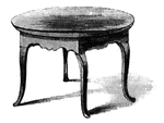
Treaty Table
The Treaty Table. The table on which the capitulation was drawn up and signed was still in possession…
Red House
The Red House. The "Red House" is situated upon the street in Wilkesbarre next the river, and about…
Vankleek House
The Vankleek House. It was built by Myndert Vankleek, one of the first settlers in Dutchess county,…
Constitution House
The Constitution House, Kingston. This house, the property and residence of James W. Baldwin, Esq.,…
![The Yeoman House. This view is from the road, looking north. An attempt was made by a soldier to burn the house, but so rapid was the march of the invaders that the flames had made but little progress before the troops were far on their road to the village. An [African American] woman, who was concealed under some corn-stalks near, extinguished the flames. The house is about half a mile from the river, on the right side of the road from the landing to Kingston village.](https://etc.usf.edu/clipart/13500/13510/yeoman_13510_mth.gif)
Yeoman House
The Yeoman House. This view is from the road, looking north. An attempt was made by a soldier to burn…
Bennington Battle-ground
The Bennington battle-ground. This view is from the hill on the southwest bank of the Walloomscoick,…
Agnew and Erskine
Head-quarters of Agnew and Erskine. This house is on the south bank of Still River, at the north end…
Ridgefield
Place of the barricade, Ridgefield. This view is at the north end of the main street. It was taken from…
Arnold's residence
Arnold's residence. Arnold lived in Water Street, near the ship-yard. The house is still standing (1848),…
Buckley House
The Buckley House. This building stood upon the eastern side of the Green, fronting the church. It was…
First Meeting House
First meeting hall. This picture of the first house for Christian worship erected in Connecticut is…
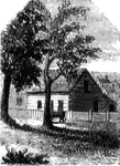
Webb House
The Webb House. This house is still standing (1848), in the central part of Wethersfield, a few rods…
Province House
"The Province House. The Province House, the residence of the colonial governors, is still standing,…
Faneuil Hall
"Faneuil Hall has been denominated 'the cradle of American liberty,' having been the popular gathering-place…
Hancock's House
"Hancock's House, Boston. This is a substantial stone building, situated upon Beacon Street, fronting…
Clark's House
"Clark's House, Lexington. This building was standing when I visited Lexington in 1848. It was built…
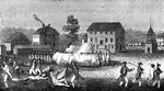
Skirmish at Lexington
"Skirmish at Lexington. The largest building in the picture is the meeting-house, and the officer on…
Barrett's House
"Colonel Barrett's House. This sketch is from the road leading to the village of Concord by the way…
Riedesel House
"The Riedesel House, Cambridge. This is from a pencil sketch by Mr. Longfellow. I am also indebted to…
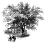
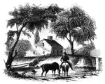
Washington Elm
"The Washington Elm. The horse seen in this sketch is one of the oldest in Cambridge, having been built…