Clipart tagged: ‘gradient’
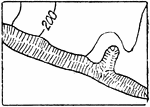
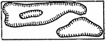
Bluffs, Other than Rocky
The typical representation of bluffs (other than rocky) on a topographical map.
Contour System
In cartography, a contour line (often just called a "contour") joins points of equal elevation (height)…
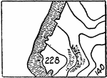
Depression Contours
The typical representation of depression contours, if otherwise ambiguous, on a topographical map.
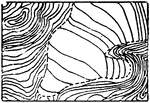
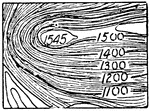
Glacier Contours
In cartography, a contour line (often just called a "contour") joins points of equal elevation (height)…
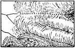
Glacier Form Lines
In cartography, a contour line (often just called a "contour") joins points of equal elevation (height)…