Clipart tagged: ‘slope’
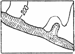
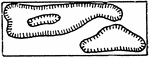
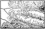
Bluffs, Other than Rocky
The typical representation of bluffs (other than rocky) on a topographical map.
Contour System
In cartography, a contour line (often just called a "contour") joins points of equal elevation (height)…
Depression Contours
The typical representation of depression contours, if otherwise ambiguous, on a topographical map.
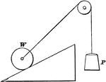
Inclined Plane with Force at an Angle to Plane and Base
"An inclined plane is a slope, or a flat surface, making an angle with a horizontal line...the force…
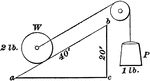
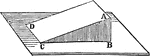
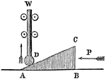
Inclined Plane with the Force Acting Parallel to the Plane
"An inclined plane is a slope, or flat surface, making an angle with a horizontal line...the force acts…
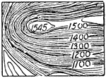
Glacier Contours
In cartography, a contour line (often just called a "contour") joins points of equal elevation (height)…
Glacier Form Lines
In cartography, a contour line (often just called a "contour") joins points of equal elevation (height)…

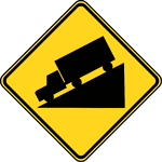
Hill, Black and White
The Hill sign should be used in advance of a downgrade where the length, percent of grade, horizontal…
Hill, Color
The Hill sign should be used in advance of a downgrade where the length, percent of grade, horizontal…
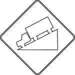
Hill, Outline
The Hill sign should be used in advance of a downgrade where the length, percent of grade, horizontal…
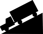
Hill, Silhouette
The Hill sign should be used in advance of a downgrade where the length, percent of grade, horizontal…
Inclined Plane
"One of the primary simple mechanical powers. The plane's surface is inclined to the horizon at any…
Irrigation by Furrows
One way to spread water over a hillside field, "f m is the main ditch and the slope of the hill as shown…
Roof With 30 degree Inclination for Trigonometry Triangle Problems
Roof with a slope of 30 degrees. Angle theta is the inclination to the horizontal of the line AB, drawn…
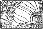
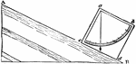
Tilted Strata
This illustration shows a rock formation that has a tilted strata. d p is the direction of the dip.…
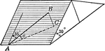
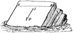
Tilted Strata
This illustration shows a rock formation that has a tilted strata. a b c d represents a square block…
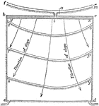
Trajectory
Trajectory is the path a moving object follows through space. A trajectory can be described mathematically…
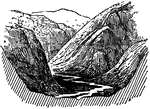
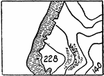
Valley
If land falls to a minimum line with a steady slope, the land form created is called a valley.
Inclined Plane Wedge
"This wedge is a movable inclined plane. Allows for raising great weights a short distance." —Quackenbos…