|
|
|
| Maps > Asia > Iraq |
A collection of historic and contemporary maps of Iraq, including ancient empires and significant archeological sites.
|
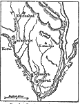
Ancient Nineveh,
1800–612 BCE |
|
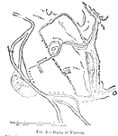
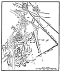
Ruins of Nineveh,
1800–612 BCE |
|
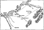
Topography of Nineveh and Vicinity,
1881 |
|
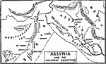
Assyria and Adjacent Countries,
200 BC |
|
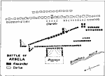
Battle of Arbela,
331 BC |
|
Babylon in the Chaldean Age,
600 BC |
|
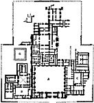
Plan of the Palace at Khorsabad,
722–705 BC |
|
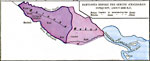
Babylonia Before the Semitic (Chaldaean) Conquest,
about 4000 BC |
| Maps > Asia > Iraq |
Maps ETC is a part of the Educational Technology Clearinghouse
Produced by the Florida Center for Instructional Technology © 2009
College of Education, University of South Florida