|
|
|
| Maps > Asia > India |
Historic and contemporary maps of India, including political and physical maps, pre-colonial and colonial maps, climate maps, and battle plans.
|
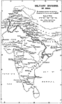
Military Divisions of India,
1912 |
|
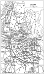
Delhi,
1912 |
|
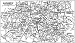
Lucknow,
1912 |
|
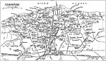
Cawnpore,
1912 |

|
Economic Activity in India,
1915 |
|
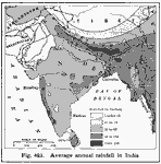
Rainfall in India,
1916 |

|
Mumbai,
1919 |
|
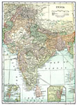
India,
1920 |
|
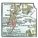
Bombay,
1920 |
|
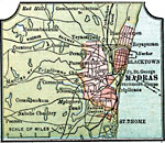
Madras,
1920 |
| First | Previous | Next | Last |
| Maps > Asia > India |
Maps ETC is a part of the Educational Technology Clearinghouse
Produced by the Florida Center for Instructional Technology © 2009
College of Education, University of South Florida