Maps Site map
  Maps > Asia > Regional Maps >Southeast Asia
Site Map  

  Record   1   to   10  of   14

Regional Asian maps of the Southeast Asia region from the Maps ETC collection. This includes physical and political maps, early history and empires, climate maps, relief maps, population density and distribution maps, cultural maps, and economic/resource maps.

The Eastern Frontier of India and Neighbouring Countries, 1805–1907
A map of Southeast Asia showing Siam (Thailand), the eastern frontier of British India, French Indo–China, and neighboring countries, subtitled ‘French and English Expansion 1805–1907.’ The map is color–coded to show the...

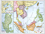
Philippines and East Asia, 1900
A map of the Philippines and East Asia in 1900 showing the political boundaries and foreign possessions at the time. The map is color-coded to show the possessions of the United States, Great Britain, France Netherlands, and Japan. The map coverage i...

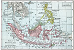
Malay Archipelago, 1901
A map from 1901 of the Malay Archipelago, including the Sunda Islands of Sumatra and Java, the island of Borneo, the Celebes, the Philippines, and the islands of the Banda Arafura Sea. The map shows the foreign possessions on Borneo (British), the Ph...

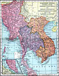
Eastern India, Burma, Siam, French Indo-China and Malay Peninsula, 1906
A map from 1906 of Eastern India, Burma, Siam, French Indo-China and Malay Peninsula showing the political boundaries and foreign possessions at the time. The map shows the boundaries of French and British military occupation of Siam (Thailand) under...

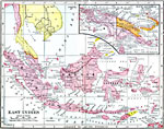
East Indies, 1906
A map from 1906 of the East Indies, including the Malay Peninsula, Borneo, Sumatra, Java, Celebes, and smaller islands, with an inset map of New Guinea or Papua. This map shows the political boundaries of the time, including the British possessions a...

Paring Down Siam, 1911
A map of Siam (Thailand) in 1911 showing the borders established by the Anglo–French agreement (Entente cordiale) of 1904. The map shows the French control of Laos, Cambodia, and northern portions of former Siamese territories, and British expa...

Farther India, Orographical, 1912
An orographical map from 1912 of the area once called Farther India or Southwest Asia. This map uses color-contours to show general land elevations ranging from sea level to above 8000 feet, and gives the 100 fathom contour line to show the submerged...

Malay States, 1912
A map from 1912 showing the political boundaries of the southern Malaysian Peninsula at the time, including the British possessions of the Straits Settlements (Malacca, Penang, Dindings, and Province Wellesley). The map shows the Malay States, major ...

Siam and Indo-China, 1912
A map from 1912 of the political boundaries of the time for the countries of Siam (Thailand), and French Indochina (Vietnam, Cambodia and Laos). These boundaries were established by the Anglo–French agreement (Entente cordiale) of 1904. The map...

Stepping Stones to Australia, 1919
A map from 1919 of the Asiatic islands from southern Japan to Australia showing the colonial holdings of Western nations in the region at the time, including the Philippines to the United States, Singapore, Sarawak, northern Borneo, and Australia to ...

Next Last


  Maps > Asia > Regional Maps >Southeast Asia
Site Map  

Maps is a part of the Educational Technology Clearinghouse
Produced by the Florida Center for Instructional Technology © 2009
College of Education , University of South Florida