|
|
|
| Maps > Europe > Italy |
Historic and contemporary maps of Italy, including political and physical maps, early empires, WWI, city plans, and battle plans.
|
Kingdom of Italy,
1861 |
|
Italy,
1872 |
|
Catacombs of Callixtus,
1881 |
|
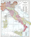
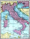
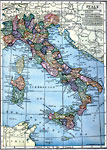
Italy,
1903 |
|
Plan of Naples,
1903 |
|
Pisa,
1903 |
|
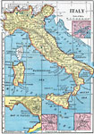
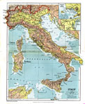
Italy,
1904 |
|
Italy and San Marino,
1906 |
|
The Situation of Venice, Italy,
1909 |
|
Italy,
1909 |
| First | Previous | Next | Last |
| Maps > Europe > Italy |
Maps ETC is a part of the Educational Technology Clearinghouse
Produced by the Florida Center for Instructional Technology © 2009
College of Education, University of South Florida