|
|
|
| Maps > Asia > Russia |
Historic and contemporary maps of Russia, including political and physical maps, early empires, territorial expansion, and city plans.
|
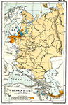
Russia,
1725 |
|
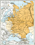
Russian Territorial Expansion ,
1725–1795 |
|
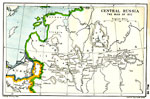
Napoleon's Invasion of Russia,
1812 |
|
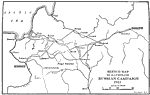
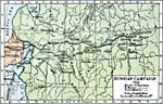
Sketch Map of the Russian Campaign,
1812 |
|
Russian Campaign of Napoleon,
1812 |
|
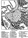
Plan of Irkutsk,
1903 |
|
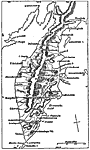
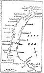
Kamchatka Peninsula,
1903 |
|
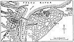
Plan of Nijni-Novgorod,
1903 |
|
Nova Zembla,
1903 |
|
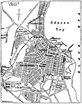
Plan of Odessa,
1903 |
| Next | Last |
| Maps > Asia > Russia |
Maps ETC is a part of the Educational Technology Clearinghouse
Produced by the Florida Center for Instructional Technology © 2009
College of Education, University of South Florida