|
|
|
| Maps > Asia > India |
Historic and contemporary maps of India, including political and physical maps, pre-colonial and colonial maps, climate maps, and battle plans.
|
India in the 19th Century,
1805–1910 |
|
India at the time of the Indian Rebellion,
1857 |
|
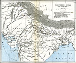
The Mutiny in Northern India,
1857–1859 |
|
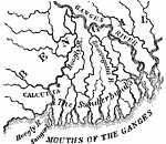
Delta of the Ganges River, India,
1873 |

|
British India,
1880 |
|
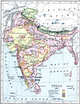
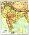
India,
1904 |
|
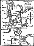
The Situation of Bombay,
1909 |
|
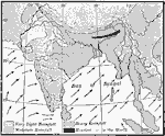
Summer Monsoon in India,
1910 |

|
Winter Monsoon in India,
1910 |

|
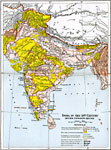
Products of India (I),
1912 |
| First | Previous | Next | Last |
| Maps > Asia > India |
Maps ETC is a part of the Educational Technology Clearinghouse
Produced by the Florida Center for Instructional Technology © 2009
College of Education, University of South Florida