Maps Site map
  Maps > Asia > Philippines
Site Map  

  Record   21   to   25  of   25

A collection of historic and contemporary political and physical maps of the Philippine Islands, including colonial period maps, for use in the K-12 classroom.
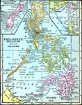
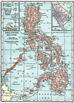
Philippine Islands, 1920
A map from 1920 of the Philippine Islands, showing the province boundaries at the time, the capital of Manila and other major cities, railways, terrain, rivers, and coastal features of the island group. The map is color–coded, breaking the isla...

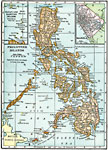
Philippine Islands, 1920
A map from 1920 of the Philippine Islands from Luzon in the north to the Sulu (or Jolo) Archipelago in the south, and including the islands of Mindanao, Negrosa, Bohol, Cebu, Leyte, Panay, Samar, Paragua, Mindoro, and Luzon.. The map shows major citi...

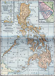
Philippine Islands , 1920
A map from 1920 of the Philippine Islands from Luzon in the north to the Sulu (or Jolo) Archipelago in the south, and including the islands of Mindanao, Negrosa, Bohol, Cebu, Leyte, Panay, Samar, Paragua, Mindoro, and Luzon.. The map shows major citi...

Philippine Islands, 1922
A map from 1922 of the Philippine Islands from Luzon in the north to the Sulu (or Jolo) Archipelago in the south, and including the islands of Mindanao, Negrosa, Bohol, Cebu, Leyte, Panay, Samar, Paragua, Mindoro, and Luzon.. The map shows major citi...

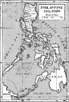
Philippine Islands, Circa 1906
An outline map from 1906 of the Philippine Islands, showing the major island names and surrounding seas. The map shows the provinces of the main island of Luzon at the time and the railway from Manila to Dagupan on the Lingayen Gulf....

First Previous


  Maps > Asia > Philippines
Site Map  

Maps ETC is a part of the Educational Technology Clearinghouse
Produced by the Florida Center for Instructional Technology © 2009
College of Education, University of South Florida