Maps Site map
  Maps > Asia > Regional Maps >Southwest Asia
Site Map  

  Record   31   to   39  of   39

Regional Asian maps of the Southwest Asia region from the Maps ETC collection. This includes physical and political maps, early history and empires, climate maps, relief maps, population density and distribution maps, cultural maps, and economic/resource maps.

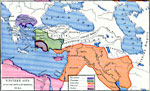
Western Asia After the Battle of Magnesia, about 190 BC
A map of western Asia after the Battle of Magnesia (190 BC), where the Romans defeated the army of Antiochus III of the Seleucid Empire during the Roman–Syrian War. This map is color–coded to show the territories at the time of Macedonia,...

The Elamitic Ascendancy in Western Asia, about 2100 BC
A map of western Asia showing the Elamitic Ascendancy and extent of the Egyptian territory during the twelfth dynasty, about 2100 BC. The map is color–coded to show the Empire of Chedor–Laomer (King of Elam) from the Mediterranean to the ...

Chaldaean Ascendancy in Western Asia, about 3800 BC
A map showing the Chaldaean or Neo–Babylonian Ascendancy in Western Asia. This map is color-coded to show the empire of Sargon of Akkad (2270 to 2215 BC) in purple, the territories of the Hittites in Herusa and Cheta in yellow, and the area whe...

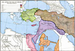
Asia After the Fall of Assyria, about 606 BC
A map of western Asia after the fall of Assyria, subtitled "Greatness of Babylon." This map is color-coded to show the empires which arose from the former Assyria, including the territories of Babylonia, Media, Egypt, and Lydia. The map shows importa...

Western Asia, about 63 BC
A map of western Asia in the Pontus (Black Sea) region at the time of the death of Mithridates VI of Pontus at the end of the third Mithridatic War in 63 BC. The map is color–coded to show the territorial expansion of the victorious Romans, the...

Western Asia, about 74 BC
A map of western Asia in the Pontus (Black Sea) region at the time of the third Mithridatic War fought between Mithridates VI of Pontus and the Roman Republic, around 74 BC. The map is color–coded to show the territory of King Mithridates, the ...

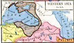
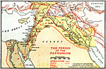
Period of the Patriarchs, Old Testament Times
Palestine lay at almost the precise center of the then known world. If one were to draw a circle of 1,600 miles diameter, with Jerusalem as the focus, all the great cities of ancient times would be included, - Rome, Athens, Ephesus, Nineveh, Babylon...

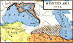
Western Asia in Early Times, Old Testament Times
The Old Testament history is embraced between the four great seas of Western Asia, — the Mediterranean, the Black, the Caspian, and the Persian Gulf. The Book of Acts and the early apostolic history includes Palestine, Syria, Asia Minor, and th...

The Russian Campaign in Asia Minor, World War I
A map of Asia Minor during WWI, showing the Eastern Theatre of War. The map shows the political boundaries at the time of Turkey in Asia, the frontiers of Russia and Persia, and the territory of Bulgaria and Armenia. Significant cities are shown. ...

First Previous


  Maps > Asia > Regional Maps >Southwest Asia
Site Map  

Maps is a part of the Educational Technology Clearinghouse
Produced by the Florida Center for Instructional Technology © 2009
College of Education , University of South Florida