Maps Site map
  Maps > Australia > Queensland
Site Map  

  Record   1   to   3  of   3

Historic and contemporary maps of Queensland, Australia, for use in the K-12 classroom.

The Situation of Brisbane, 1919
A map of Brisbane, the capital of Queensland, Australia, and surrounding area in 1919, including neighboring cities and railways, rivers, and Moreton Bay....

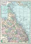
Queensland, 1920
A map of Queensland, Australia in 1920, showing counties, cities and ports, railways, submarine cable and important overland telegraph routes, rivers, lakes, mountains, and coastal features. The map shows the Great Barrier Reef and Torres Straight be...

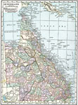
Queensland, 1920
A map of Queensland, Australia in 1920, showing counties, cities and ports, railways, submarine cable and important overland telegraph routes, rivers, lakes, mountains, and coastal features. The map shows the Great Barrier Reef and Torres Straight be...


  Maps > Australia > Queensland
Site Map  

Maps ETC is a part of the Educational Technology Clearinghouse
Produced by the Florida Center for Instructional Technology © 2009
College of Education, University of South Florida