| Maps > Europe > France |
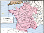 |
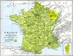
France after the peace of Aix-la-Chapelle in 1668, 1668 Map of France after the peace of Aix-la-Chapelle in 1668. Map is color-coded to show French land acquisitions. |
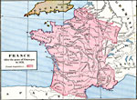 |
France after the peace of Nimnegan in 1678, 1678 Map of France after the peace of Nimnegan in 1678. Map is color-coded to show French land acquisitions. |
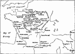 |
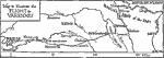
Places Mentioned in Dickens' Works, 1910 Map shows the regions connected with poets from The Lake District, from "Idylls of the King," by Thomas De Quincey. |
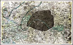 |
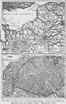
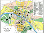
Paris and Vicinity, 1903 A map of Paris and its vincinity in 1903. |
 |
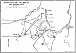
Flight to Varennes, 1791 A map to illustrate the flight to Varennes. |
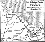 |
North Eastern Frontier of France, 1792 A map of the Northeastern Frontier of France, showing the military position in September of 1792. |
 |
Paris at the Time of the Revolution 1790-1795, 1910 See Carlyle, Burke, etc. |
 |
Medieval Paris, 1910 See Balzac's "Catherine de Medici," Hugo's "Notre Dame," Dumas' Novels, etc. |
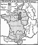 |
France at the Close of the 10th Century, 999 A map of France at the close of the 10th century. |
 |
The Seat of War in Northern France, 1870-1871, 1870-1871 Map of the Seat of War in Northern France, 1870-1871. Map is color-coded to differentiate between the different countries in the area. |
 |
France 1618-1648, 1618-1648 |
 |
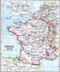
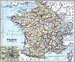
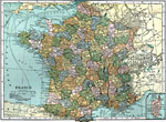
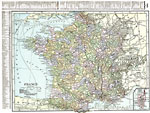
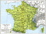
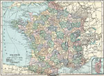
France, 1909 Map of France. |
|
Paris and Vicinity, 1903 A map of Paris and its vincinity in 1903. |
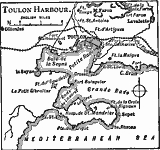 |
Toulon Bay, 1919 A map of Toulon, a French port on the Mediterranean. |
 |
Paris, Map to show Paris and surrounding country. |
|
Flight to Varennes, 1791 A map to illustrate the flight to Varennes. |
|
North Eastern Frontier of France, 1792 A map of the Northeastern Frontier of France, showing the military position in September of 1792. |
 |
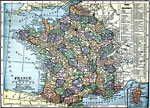
France, 1910 Map shows France. |
 |
France, 1906 Map of France in 1906. |
|
France, 1906 Map of France in 1906. |
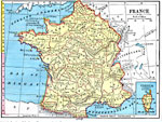 |
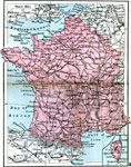
France, 1872 Physical map of France with a map insert of Corsica. |
 |
Eastern Frontier of France, 1559 Map showing the Eastern Frontier of France, subtitled "Wars of France and the Empire 1521-1559." |
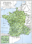 |
France - The Religious Wars, late 1500s-early 1600s Map of France, subtitled "The Religious Wars with inset of the Neighbourhood of Paris." |
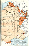 |
Eastern France, 1643-1715 Map of Eastern France, subtitled "Territorial Acquisitions during the Reign of Louis XIV." Map is color-coded to show France's acquisitions during 1643-1715. |
 |
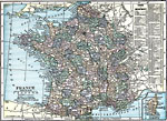
France, 1920 France, showing railroads, canals, submarine cables, and important tramways. |
 |
France, 1920 Map of France. |
 |
France Plate I, 1920 First in a series of maps of France. |
 |
Battles of the Somme, 1916-1918 A map of the Somme, where many battles during the First World War were fought. |
 |
France Plate II, 1920 Second in a series of regional maps of France. |
 |
France Plate III, 1920 Third in a series of regional maps of France. |
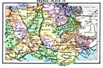 |
France Plate IV, 1920 Fourth in a series of regional maps of France. |
 |
Detail Map of the Picardy Drive, 1914 A detail map of the Picard Drive during World War 1. |
 |
France, 1920 Map of France. |
 |
France, 1919 A map of France in 1919. |
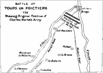 |
Battle of Tours or Poictiers Showing Original Position of Charles Martel's Army, 732 Map shows Battle of Tours or Poictiers 732 A.D. |
 |
German Lines, 1918 A map showing the German concentration the American Army broke through. Up to September 26, 1918, the German defense lines were as indicated by the heavy lines. In Belgium, Artois, and Champaigne, the first, second, third, and fourth trench lines were considerable distances apart. In the Argonne sector, however, all four of them were practically together. |
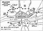 |
Orleans Before Joan of Arc's Entry, Map shows Orleans Before Joan of Arc's Entry. |
 |
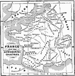
France before the Revolution, 1700s Map of France before the Revolution. Map is color-coded to show products produced in various areas of U.S. |
 |
Paris during the Revolution, Map of Paris during the Revolution. Map is color-coded to show different parts of city. |
 |
Eastern Frontier of France, Map of showing the Eastern Frontier of France, subtitled "Revolutionary Campaigns 1792-1795." Map is color-coded to show the different countries. |
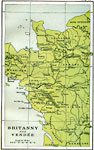 |
Brittany and Vendee, Map showing Brittany and Vendee, along the west coast of France. |
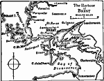 |
The Harbor of Brest, 1919 A map of the harbor of Brest around 1919. |
 |
France and Neighboring Countries, 1066-1154 A map of France and the neighboring countries. |
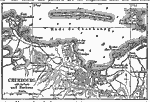 |
Cherbourg Harbor, 1919 A map showing Cherbourg, a French port, around 1919. |
 |
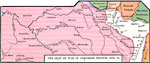
The Frontier of France, 1648-1459 A map showing the districts ceded to France in 1648 and 1659. |
|
German Lines, 1918 A map showing the German concentration the American Army broke through. Up to September 26, 1918, the German defense lines were as indicated by the heavy lines. In Belgium, Artois, and Champaigne, the first, second, third, and fourth trench lines were considerable distances apart. In the Argonne sector, however, all four of them were practically together. |
|
France 1618-1648, 1910 |
 |
North Eastern Frontier of France, 1815 Map showing the northeastern frontier of France, subtitled "The Waterloo Campaign 1815." Map is color-coded to highlight boundary between countries. |
|
France and Neighboring Countries, 1066-1154 A map of France and the neighboring countries. |
|
Battles of the Somme, 1916-1918 A map of the Somme, where many battles during the First World War were fought. |
|
Detail Map of the Picardy Drive, 1914 A detail map of the Picard Drive during World War 1. |
|
France, 1910 Map shows France. |
|
France, 1919 A map of France in 1919. |
|
The Frontier of France, 1648-1459 A map showing the districts ceded to France in 1648 and 1659. |
|
Places Mentioned in Dickens' Works, 1910 Map shows the regions connected with poets from The Lake District, from "Idylls of the King," by Thomas De Quincey. |
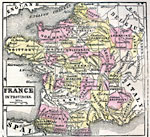 |
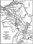
France in Provinces, French Revolution Map of France in Provinces. |
|
The Harbor of Brest, 1919 A map of the harbor of Brest around 1919. |
|
Battle of Tours or Poictiers 732 A.D. Showing Original Position of Charles Martel's Army, 1910 Map shows Battle of Tours or Poictiers 732 A.D. |
 |
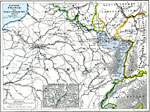
Gravelotte-St.Privat, August 18, 1870 A map of Gravelot - St. Privat on August 18, 1870. |
|
Orleans Before Joan of Arc's Entry, 1910 Map shows Orleans Before Joan of Arc's Entry. |
 |
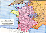
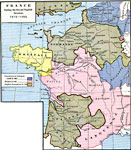
France since 1814, 1815-1871 Map showing France since 1814. Map is color-coded to show lands acquired & ceded. |
 |
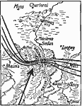
The Battle of Sedan, September 1, 1870 The Battle of Sedan during the Franco-German War, which took place on September 1, 1870. |
|
Cherbourg Harbor, 1919 A map showing Cherbourg, a French port, around 1919. |
|
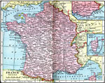
France, 1909 Map of France. |
 |
France at the Death of Charles V in 1380, 1380 Map of England and France during the first English invasion of France. |
|
Toulon Bay, 1919 A map of Toulon, a French port on the Mediterranean. |
|
Paris at the Time of the Revolution 1790-1795, 1910 See Carlyle, Burke, etc. |
|
Medieval Paris, 1910 See Balzac's "Catherine de Medici," Hugo's "Notre Dame," Dumas' Novels, etc. |
|
France at the Close of the 10th Century, 999 A map of France at the close of the 10th century. |
 |
France, 1920 Physical map of France with a map insert of Corsica. Includes railroads, important tramways, and submarine cables. |
 |
France during the Second English Invasion, 1415-1453 Map of France during the Second English Invasion. Map is color-coded to distinguish English land from French land. |
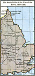 |
The Battlefields of the War of the Roses, 1455-1485, 1455-1485 Map showing the Battlefields of the War of the Roses, 1455-1485. |
 |
Joan of Arc's Country, 1415-1485 Map showing Joan of Arc's Country. |
 |
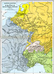
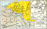
Eastern France, 1870-1871 Map of Eastern France, subtitled "The Franco-Prussian War 1870-71." Map is color-coded to show territory ceded by France to Germany. |
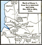 |
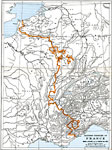
March of Henry V from Eu to Agincourt and Calais Oct. 12 to 29th, 1415, 1415 Map showing the March of Henry V from Eu to Agincourt and Calais, Oct. 12 to 29th, 1415. |
|
Gravelotte-St.Privat, August 18, 1870 A map of Gravelot - St. Privat on August 18, 1870. |
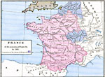 |
France at the accession of Louis XI in 1461, 1461 Map of France at the Accession of Louis XI in 1461. Map is color-coded to show possessions of the House of Burgundy. |
|
The Battle of Sedan, September 1, 1870 The Battle of Sedan during the Franco-German War, which took place on September 1, 1870. |
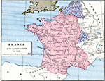 |
France at the death of Louis XI in 1483, 1483 Map of France at the Accession of Louis XI in 1461. Map is color-coded to show possessions of the House of Burgundy. |
| Maps > Europe > France |
Maps is a part of the Educational Technology Clearinghouse
Produced by the Florida Center for Instructional Technology © 2007
College of Education, University of South Florida