|
|
|
| Maps > Europe > Belgium |
A collection of historic and contemporary maps of Belgium, including significant battle plans for use in the K-12 classroom.

|
Plan of Cathedral at Tournai,
1146–1325 |

|
Defenses of Antwerp,
1903 |
|
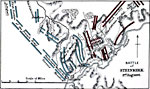
Battle of Steinkirk,
August 3, 1692 |
|
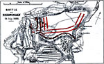
Battle of Neerwinden,
July 29, 1693 |
|
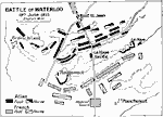
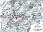
Battle of Waterloo,
June 18, 1815 |
|
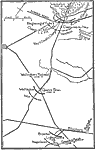
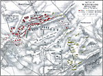
Battle of Waterloo,
June 18, 1815 |
|
Battle of Waterloo,
June 18, 1815 |
|
Battle of Waterloo,
June 18, 1815 |
| Maps > Europe > Belgium |
Maps ETC is a part of the Educational Technology Clearinghouse
Produced by the Florida Center for Instructional Technology © 2009
College of Education, University of South Florida