|
|
|
| Maps > Europe > Denmark |
Historic and contemporary maps of Denmark, including battle plans, for use in the K-12 classroom.
|
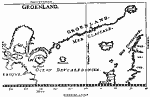
Greenland,
1647 |
|
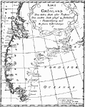
Greenland,
1668 |
|
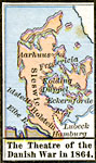
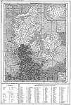
The Theatre of the Danish War,
1864 |
|
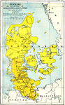
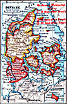
Denmark and the Duchies of Schleswig and Holstein,
1864 |
|
Denmark with Schleswig-Holstein,
1914 |
|
Denmark,
1914–1919 |
|
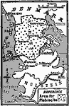
Remaking the Frontier of Denmark,
1919 |
|
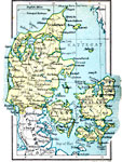
Denmark,
1920 |
|
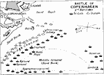
Battle of Copenhagen,
April 2, 1801 |
|
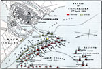
Battle of Copenhagen,
April 2, 1801 |
| Maps > Europe > Denmark |
Maps ETC is a part of the Educational Technology Clearinghouse
Produced by the Florida Center for Instructional Technology © 2009
College of Education, University of South Florida