|
|
|
| Maps > Europe > France |
Historic and contemporary maps of France, including political and physical maps, early empires, WWI, city plans, and battle plans.
|
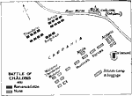
Battle of Chalons,
AD 451 |
|
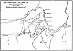
Gravelotte-St.Privat,
August 18, 1870 |
|
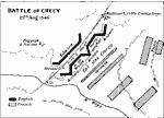
Battle of Crecy,
August 25, 1346 |

|
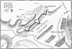
Crecy,
August 26, 1346 |
|
Battle of Crecy,
August 26, 1346 |
|
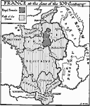
France at the Close of the 10th Century,
Circa A.D. 999 |
|
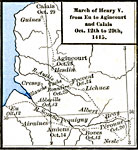
March of Henry V from Eu to Agincourt and Calais,
October 12 to 29th, 1415 |
|
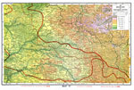
Highlands of Northern France during WWI,
October 20, 1918 |
|
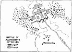
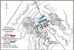
Battle of Agincourt,
October 25, 1415 |
|
Battle of Agincourt,
October 25, 1415 |
| First | Previous | Next | Last |
| Maps > Europe > France |
Maps ETC is a part of the Educational Technology Clearinghouse
Produced by the Florida Center for Instructional Technology © 2009
College of Education, University of South Florida