|
|
|
| Maps > Europe > Germany |
Historic and contemporary maps of Germany, including political and physical maps, early empires, WWI, city plans, and battle plans.

|
Plan of Cathedral of Spires,
1030–1061 |
|
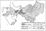
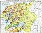
Growth of Brandenburg-Prussia,
1400–1806 |
|
Germany at the Accession of Charles V,
1519 |

|
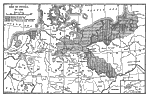
Brandenburg Prussia,
1525–1648 |
|
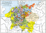
Germany Divided into 10 Imperial Circles,
1543 |

|
Germany - Schmalkaldic War,
1547–1554 |
|
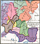
Religious Divisions of Germany,
1610 |
|
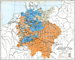
Germany at the Start of the 30 Years War,
1618 |

|
Germany,
1648 |
|
Rise of Prussia,
1786 |
| Next | Last |
| Maps > Europe > Germany |
Maps ETC is a part of the Educational Technology Clearinghouse
Produced by the Florida Center for Instructional Technology © 2009
College of Education, University of South Florida