Maps Site map
  Maps > Europe > Italy
Site Map  

  Record   31   to   40  of   101

Historic and contemporary maps of Italy, including political and physical maps, early empires, WWI, city plans, and battle plans.

Venice and Vicinity, 1909
A map of Venice, Italy and the surrounding area in 1909, showing the Lagoon of Venice, the freshwater aqueduct, and the Porto di Lido....

Italy, 1910
A map of Italy in 1910, color–coded to show the larger compartimenti (provinces) prior to the resolution of the Italian Irredentist Movement. This map shows the territories of Tyrol, Istria, and Dalmatia under Austria–Hungary Empire rule,...

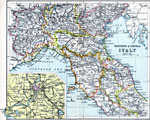
Northern and Central Italy, 1910
A map of northern and central Italy in 1910 showing the provinces of Piedmont, Lombardy, Venetia, Liguria, Emilia, Tuscany, Umbria, Marches, Rome, Abruzzi and Molise. The map shows major cities, towns, ports, railways, rivers, lakes, and terrain. An ...

Italy, 1912
A map of Italy in 1912 showing provinces, cities, mountain ranges, waterways, and railroads....

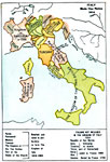
Italy, 1914
A map of the Kingdom of Italy in 1914 subtitled "Made One Nation." This map shows the unification of Italy with dates and notations for annexation to the Kingdom of Sardinia (the founding state, which became the Kingdom of Italy in 1861). T...

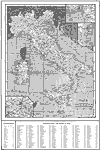
Italy, 1914
A map of Italy in 1914 showing major cities, towns, ports, railways, coastal features and rivers. The map includes insets detailing Rome, Bay of Naples, and Venice, and a reference key to Compartments and principal cities and towns....

Italy, 1914–1919
A map from 1919 of Italy shortly after World War I. The map shows the 17 political divisions or Compartimenti, and the 69 provinces, and the northern boundaries at the time, including the territories of Trentino, Gorizia, Istria, and part of Dalmatia...

Italian Front, 1914–1919
A map from 1919 of the northeastern Italian fronts during World War I, including the front in 1917 and in 1918. The map shows principal cities and ports, railroads, mountains, rivers, and coastal features....

Apennine Peninsula, 1915
Physical map of the Apennine Peninsula (Italy) showing major cities (including cities with a population over one million), major landforms and waterways. The map includes Corsica, Sardinia, and Sicily, and portions of Switzerland and Austria–Hu...

Rome and Vicinity, 1916
A map of Rome and the surrounding vicinity in 1916 showing the River Tiber, lakes and terrain, the Appian Way, railways, and the cities of Fiumicino, Ostia, Tivoli, Frascati, Marino, Albano and Genzano....

First Previous Next Last


  Maps > Europe > Italy
Site Map  

Maps ETC is a part of the Educational Technology Clearinghouse
Produced by the Florida Center for Instructional Technology © 2009
College of Education, University of South Florida