|
|
|
| Maps > Europe > Italy |
Historic and contemporary maps of Italy, including political and physical maps, early empires, WWI, city plans, and battle plans.
|
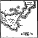
Kingdom of Dionysius,
367 BC |
|
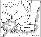
Plan of Syracuse,
415–413 B.C. |
|
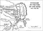
Syracuse at the Time of the Siege,
415–413 BC |
|
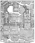
Plan of fora of Julius, Augustus, and Nerva,
46 BC to AD 113 |

|
Plan of Part of the Cemetery of Sant Agnese,
4th Century AD |
|
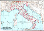
Ancient Italy,
509 BC to AD 476 |
|
Italy,
650 |

|
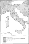
Italy Divided by Augustus into Eleven Regions,
7 BC |
|
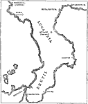
Chief Greek Colonies in Southern Italy,
734–710 BC |
|
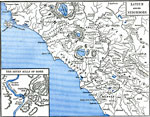
Latium and Neighbors,
750 BC |
| First | Previous | Next | Last |
| Maps > Europe > Italy |
Maps ETC is a part of the Educational Technology Clearinghouse
Produced by the Florida Center for Instructional Technology © 2009
College of Education, University of South Florida