Maps Site map
  Maps > Europe > Italy
Site Map  

  Record   91   to   100  of   101

Historic and contemporary maps of Italy, including political and physical maps, early empires, WWI, city plans, and battle plans.
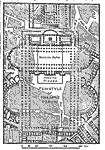
Forum of Trajan, AD 100–117
A plan of the Forum of Trajan in Rome. The map shows surrounding roads and buildings, and details the Temple of Trajan, Columna Trajana and libraries, Basilica Ulpia, and the Modern Piazza. "The forum of Trajan with its adjacent buildings was th...

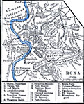
Roma, AD 116
A plan of Rome, Italy, circa AD 116, showing the River Tiber, the Seven Hills of Rome, city walls, major roads, bridges, aqueducts, and keyed references to the principle buildings of the city....

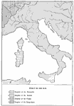
Italy, AD 525
A map of Italy at the time of Ostrogoth rule under Theodoric the Great (AD 454–526) after the fall of the Western Roman Empire. This map shows the extent of the Kingdom of the Ostrogoths, Kingdom of the Vandals (Corsica and Sardinia), and porti...

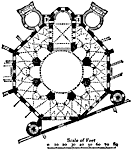
Plan of San Vitale, Ravenna, AD 539–547
This is a plan of the San Vitale in Ravenna, Italy. It was built from 539 to 547 AD. This is an example of Early Christian architecture. The scale is in feet....

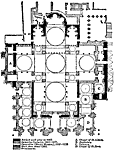
Plan of St Mark's, Venice, AD 929–1063
This is a plan of the St Mark's, in Venice, Italy. Erected AD 929 to 1063. This is an example of Italian Byzantine Romanesque architecture. This church was created in order to "reproduce in some way the leading features of the church of the Holy...

Northern Italy Illustrating Bonaparte's First Campaign, April, 1796 to April, 1797
"All through this Italian campaign Bonaparte acted as if he were the head of the state, not its servant... He became a creator and a destroyer of states. Italy was not at that time a united country but was a collection of small, independent stat...

The Peoples around Rome, Circa 405 BC
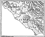
A map showing the proximity of the enemies (Etrusci, Sabini, Aequi, and Volsci) and allies (Latini and Hernisci) of early Rome....

Vicinity of Ancient Rome, Circa 800 B.C.
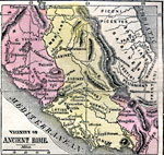
A map showing the vicinity of ancient Rome, including the Tiber River, Mons Sacer, and the territories of the Etruscans, Umbrians, Sabines, Picentes, Pelignians, &Aelig;quians, Latins, Hernici, Frentani, Volscians, and Samnites. The map shows importa...

Ancient Italy, Circa 800 BC
Map of Ancient Italy with the neighboring countries subject to the Romans. This map shows the names of provinces in Latin, including Etruria, Latium, Campania, Umbria, Picenum, Samnium, Apulia, Calabria, Lucania, and Ager, with neighboring countries ...

The Capitoline Hill and the For a, First Century A.D.
A plan of the Capitoline Hill and the Fora in Rome during the First Century AD. The plan shows the Temple of Jupiter (1), Temple of Juno (2), Aerarium (3), Temple of Saturn (4), Temple of Concord (5), Tullianum (6), Arch of Severus (7), Senate Hall (...

First Previous Next Last


  Maps > Europe > Italy
Site Map  

Maps ETC is a part of the Educational Technology Clearinghouse
Produced by the Florida Center for Instructional Technology © 2009
College of Education, University of South Florida