|
|
|
| Maps > Europe > Regional Maps >Central Europe |
Regional European maps of the Central Europe region from the Maps ETC collection. This includes physical and political maps, early history and empires, WWI maps, climate maps, relief maps, vegetation maps, population density and distribution maps, cultural maps, and economic/resource maps.
|
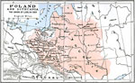
Poland and Lithuania,
1569 |
|
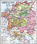
Germany and Northern Italy - Reformation to 30 Years War,
1615–1648 |
|
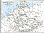
Germany during The Thirty Years War,
1619–1629 |
|
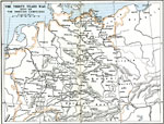
The Thirty Years War - The Swedish Campaigns,
1630–1648 |
|
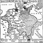
Central Europe at the Peace of Westphalia,
1648 |
|
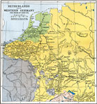
Netherlands and Western Germany,
1648–1715 |
|
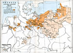
Prussia,
1648–1795 |
|
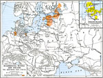
Scandinavia, Russia, and Poland,
1700–1721 |
|
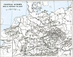
Central Europe and the Wars of Frederick the Great ,
1740–1784 |
|
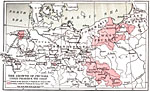
The Growth of Prussia Under Frederick the Great,
1740–1786 |
| Next | Last |
| Maps > Europe > Regional Maps >Central Europe |
Maps
is a part of the
Educational Technology Clearinghouse
Produced by the
Florida Center for Instructional Technology
© 2009
College of Education
,
University of South Florida