Maps Site map
  Maps > Globes and Multi-continent > Complete Maps
Site Map  

  Record   1   to   10  of   303

A collection of world and multi-continent maps, including various projections, hemispheric maps, physical and political maps, early known world maps, climate maps, relief maps, ocean current maps, population density and distribution maps, vegetation maps, and economic/resource maps.

Quadrans Habitabilis according to Abu Rihan Birunensis, 1030
A facsimile from 1912 of the habitable world (Quadrans Habitabilis) according to the Persian scholar and geographer Abu Rihan Birunensis (Abu Rayhan Biruni) in AD 1030. This map shows Europe, Asia, and North Africa as it was known, with the place nam...

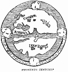
Early Map of the World, 1400–1499
A facsimile of a world map from the fifteenth century, showing a conventional map of the older period, which is given in Santarem's Atlas as a "Mappemonde qui se trouve au revers d'une Médaille du Commencement du XVe Siècle." ...

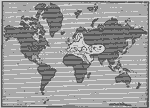
The Known World, 1400–1499
A map from 1920 showing the extent of the European's known world in the fifteenth century, which consisted primarily of western and southern Europe, parts of western Asia, Middle East, and North Africa, shown in white. The ‘unknown’ porti...

The World as known to Europe , 1418
A facsimile of a map of the world as known to Europe about the year 1418. This map "traced the outline of the world as known to the geographers of Europe in the first quarter of the fifteenth century. This was before the famous navigator, Prince...

The World as known in the time of Columbus, 1450–1492
A map from 1911 showing the part of the world (shown in white) known to Europeans when Columbus sailed in 1492. The map shows Europe, northern Africa, including the west coast of Africa explored by the Portuguese, the southern portion of Greenland ex...

Known World at the Time of Columbus, 1492
A map from 1898 showing the part of the world (shown in white) known to Europeans when Columbus sailed in 1492. The map shows Europe, northern Africa, including the west coast of Africa explored by the Portuguese, the southern portion of Greenland ex...

Columbus, Magellan, and De Gama, 1492–1522
A sketch map of the world from 1898, showing the voyages of Columbus to the Americas (1492), Vasco de Gama to India (1498), and the voyage of Magellan (1519–1522)....

Chief Voyages of Exploration, 1492–1522
A map of the world, showing the chief European voyages of exploration between the Norsemen (before AD 1000) up to the return of the Magellan expedition in 1522. The map shows coasts visited by European explorers, including the Portuguese voyages alon...

Great Voyages, 1492–1580
A world map from 1911 showing the voyages of European exploration between 1492 and 1580. The map shows the routes of Columbus (1492), De Gama (1497), Cabot (1497), Vespucius (1501), Magellan (1519–1522, including the site in the Philippines whe...

World Discoveries , 1500–1700
This is a map of the World showing discoveries from 15th to 17th centuries. Shows continents, countries and major cities of the time, major river ways, topography, and voyages. Scale in English miles. The voyages of Magellan, Drake, Vasco de Gama, Co...

Next Last


  Maps > Globes and Multi-continent > Complete Maps
Site Map  

Maps ETC is a part of the Educational Technology Clearinghouse
Produced by the Florida Center for Instructional Technology © 2009
College of Education, University of South Florida