|
|
|
| Maps > Globes and Multi-continent > Northern Hemisphere |
A collection of political, physical, climate, and relief maps of the Northern Hemisphere for use in the K-12 classroom.
|
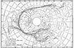
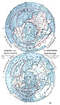
Average Seasonal Storm Tracks in the Northern Hemisphere,
1878–1887 |
|
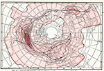
Cyclone Frequency,
1878–1887 |
|
Magnetic Meridians in the Northern Hemisphere,
1888 |
|
Seasonal Isothermal Charts of the Northern Hemisphere,
1888 |
|
Isobaric and Wind Charts of Northern Hemisphere,
1888 |
|
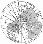
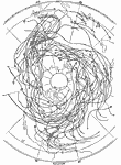
Typical Paths of Cyclones in the Northern Hemisphere,
1896 |
|
Relief Map of the Northern Hemisphere,
1909 |
|
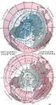
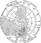
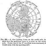
View from the North Pole,
1910 |
|
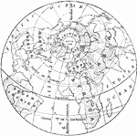
North Pole,
1910 |
|
Northern Hemisphere,
1919 |
| Next | Last |
| Maps > Globes and Multi-continent > Northern Hemisphere |
Maps ETC is a part of the Educational Technology Clearinghouse
Produced by the Florida Center for Instructional Technology © 2009
College of Education, University of South Florida