| Maps > Globes and Multi-Continent > Regional Maps |
Below are several options for Globes and Multi-Continent regional maps from the Maps ETC collection. Regional maps are maps which extend beyond the border of a single country or continent, encompassing a major area of the Earth. Browse the locater maps to find the regional area that is needed, and click the image or given link for historical and contemporary maps of that region. If you do not find a specific region you are looking for, you can check the Globes and Multi-Continent Regional Maps, Misc. page, which contains combinations of several regions.
|
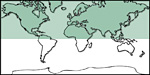
Northern Hemisphere
|
|
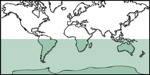
Southern Hemisphere
|
|
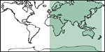
Eastern Hemisphere
|
|
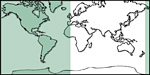
Western Hemisphere
|
|
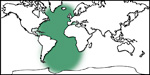
Atlantic Ocean
|
|
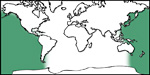
Pacific Ocean
|
|
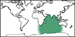
Indian Ocean
|
|
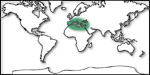
Mediterranean Region
|
|
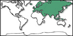
Transcontinental: Asia, Europe
|
|
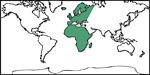
Transcontinental: Europe, Africa
|
|
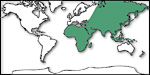
Transcontinental: Asia, Africa
|
|
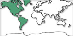
Transcontinental: North America, South America
|
|
Globes and Multi-Continent Regional Maps, Misc
|
| Maps > Europe > Regional Maps |
Maps is a part of the Educational Technology Clearinghouse
Produced by the Florida Center for Instructional Technology © 2009
College of Education, University of South Florida