|
|
|
| Maps > Globes & Multi-Continent > Regional Maps >Regional Miscellaneous |
Regional Globes & Multi-Continental maps of the Regional Miscellaneous region from the Maps ETC collection. This may include physical and political maps, early history and empires, climate maps, relief maps, vegetation maps, population density and distribution maps, cultural maps, and economic/resource maps.

|
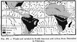
Winds and Rain in South America and Africa from December to February,
1910 |

|
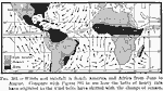
Winds and Rain in South America and Africa from June to August,
1910 |
|
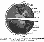
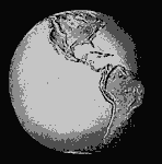
The Globe,
1910 |
|
Mean Annual Rainfall of the World,
1910 |
|
Mean Annual Rainfall of the World,
1910 |
|
The Old World,
1912 |
|
The New World,
1912 |
|
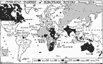
Overseas Empires of European Powers,
1914 |
|
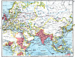
Trade Routes Between Europe and Asia,
1915 |

|
Examples of Settlements,
1915 |
| First | Previous | Next | Last |
| Maps > Globes & Multi-Continent > Regional Maps >Regional Miscellaneous |
Maps
is a part of the
Educational Technology Clearinghouse
Produced by the
Florida Center for Instructional Technology
© 2009
College of Education
,
University of South Florida