Maps Site map
  Maps > Globes & Multi-Continent > Regional Maps >Regional Pacific Ocean
Site Map  

  Record   31   to   40  of   44

Regional Globes & Multi-Continental maps of the Regional Pacific Ocean region from the Maps ETC collection. This may include physical and political maps, early history and empires, climate maps, relief maps, vegetation maps, population density and distribution maps, cultural maps, and economic/resource maps.
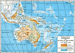
Physical map of Australia and islands of the Pacific, 1910
Physical map of Australia and islands of the Pacific in 1910 showing general color–coded elevations and water depths from 13,000 feet below sea level to over 6,500 feet above sea level. This map covers Australia and New Zealand, and from Sumatr...

Pacific Ocean, 1912
Map of the western part of the Pacific Ocean with Borneo at the western part of the map, and the Hawaiian Islands at the eastern part. Shows the countries and islands that are along this side of the Pacific as well as major cities and water routes....

Fiji Islands, 1913
A map of the Fiji Island group from 1903. The map shows the major island of Viti Levu and capital city of Suva, the neighboring island of Vanua Levu, and the smaller islands of the Koro Sea and Yasaua group....

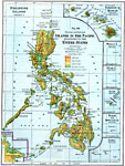
American Islands in the Pacific, 1916
A map showing the American possessions and territorial claims in the Pacific in 1916. The map details the Philippine Islands with the boundary of the British North Borneo territory, the territory of Hawaii, Midway Island, Wake Island, Guam, Baker and...

Australia and Islands of the Pacific, 1916
A map from 1916 of Australia and islands of the Pacific from Sumatra and Borneo in the northeast to Tahiti in the east. The map shows the states of Australia, the East Indies, Micronesia, Polynesia, New Zealand, major cities, rivers, and terrain feat...

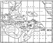
Administration of the Pacific, 1919
A map from 1919 showing the islands and administrative boundaries of the Pacific, with new administration as fixed by the Supreme Council of the Allies. The question of American rights in some of these islands was among the topics discussed in arrang...

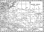
The Pacific Ocean, 1919
A map of the Pacific Ocean from 1901 showing shipping routes. The map coverage is between latitudes 45° N and 20° S, and longitudes 110° E and 150° W of Greenwich. The map shows major oceanic islands, foreign possessions, cities and po...

German Surrenders in Asia and the Pacific, 1919
A map from 1919 showing the German territorial possessions in Asia and the Pacific ceded to the Allies and associated governments at the end of WWI. The map shows the former territories of Tien Tsin (Tianjin) and Hankow (Hankou) China, Siam (Thailand...

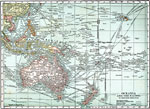
Oceania and the Pacific, 1920
A map from 1920 of Oceania and the Pacific on a Mercator's Projection between latitudes 30° N and 50° S, and longitudes 100° E and 140° W of Greenwich. This map shows cities and ports, ocean steamer routes with distances between major ...

Oceana and the Pacific, 1920
A map from 1920 of Oceania and the Pacific between latitudes 30° N and 50° S, and longitudes 100° E and 140° W of Greenwich. This map is drawn on a Mercator's Projection, and shows cities and ports, ocean steamer routes with distances ...

First Previous Next Last


  Maps > Globes & Multi-Continent > Regional Maps >Regional Pacific Ocean
Site Map  

Maps is a part of the Educational Technology Clearinghouse
Produced by the Florida Center for Instructional Technology © 2009
College of Education , University of South Florida