Maps Site map
  Maps > North America > Canada
Site Map  

  Record   111   to   120  of   156

Historic and contemporary maps of Canada including physical and political maps of provinces and territories, early exploration and settlement, climate, vegetation, battle plans, geomorphic, and automobile route maps.
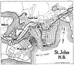
St. John, 1919
A map of St. John, New Brunswick, from Official Automobile Blue Book of 1919. The map shows the Bay of Fundy, Courtenay Bay, and River St. John, the major roads, railroads and stations, parks, cemeteries, the harbor, and neighboring cities....

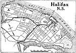
Halifax, 1919
A map of Halifax, Nova Scotia, from Official Automobile Blue Book of 1919. The map shows the Halifax Harbor, the major roads, docks, railroads and stations, schools, citadel, parks, and government buildings....

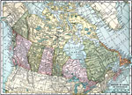
The Dominion of Canada and Newfoundland , 1920
A map from 1920 of the Dominion of Canada and Newfoundland (Newfoundland and Labrador were not part of the Canadian Confederation until 1949), showing the provinces at the time, provincial capitals, major cities, towns, and settlements, railways, sub...

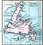
Newfoundland, 1920
A map from 1920 of Newfoundland showing the cities and towns, railway, lakes, and coastal features of the island. The map also shows the French islands of Miquelon and Saint Pierre, and the Belleisle and Cabot straits in the Gulf of St. Lawrence....

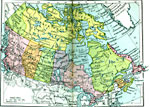
The Dominion of Canada and Newfoundland, 1920
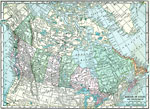
A map from 1920 of the Dominion of Canada and Newfoundland showing the provinces at the time, provincial capitals, major cities, towns, and settlements, railways, mountain systems, lakes, rivers, coastal features, and islands of the region....

The Dominion of Canada and Newfoundland, 1920
A map from 1920 of the Dominion of Canada and Newfoundland (Newfoundland and Labrador were not part of the Canadian Confederation until 1949), showing the provinces at the time, provincial capitals, major cities, towns, and settlements, railways, sub...

Maritime Provinces of Canada, 1920
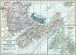
A map from 1920 of the Canadian Maritime Provinces of New Brunswick, Nova Scotia, and Prince Edward Island, with an inset map of Newfoundland. The map shows the county boundaries within the provinces, the provincial capitals of Fredericton (New Bruns...

Province of Quebec, 1920
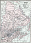
A map from 1920 of the province of Quebec from the St. Lawrence River to Hudson Bay and the Hudson Strait. The map shows the Dominion capital of Ottawa, Province capital of Quebec City, major cities and towns, existing and proposed railways, canals, ...

South Central Quebec, 1920
A map from 1920 of the south–central part of the province of Quebec, showing county boundaries and county seats, the Dominion capital of Ottawa, Province capital of Quebec City, major cities, towns, and ports, existing and proposed railways, ca...

Southern Ontario, 1920
A map from 1920 of the southern part of the province of Ontario. The map shows the county boundaries and county seats, Dominion capital of Ottawa, the provincial capital of Toronto, major cities and towns, existing and proposed railways, canals, prov...

First Previous Next Last


  Maps > North America > Canada
Site Map  

Maps ETC is a part of the Educational Technology Clearinghouse
Produced by the Florida Center for Instructional Technology © 2009
College of Education, University of South Florida