Maps Site map
  Maps > North America > Canada
Site Map  

  Record   131   to   140  of   156

Historic and contemporary maps of Canada including physical and political maps of provinces and territories, early exploration and settlement, climate, vegetation, battle plans, geomorphic, and automobile route maps.

Saskatchewan, 1920
A map from 1920 of the province of Saskatchewan, showing the provincial capital of Regina, major cities and towns, railways, terrain features, lakes, and rivers....

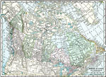
The Dominion of Canada and Newfoundland, 1920
A map from 1920 of the Dominion of Canada and Newfoundland (Newfoundland and Labrador were not part of the Canadian Confederation until 1949), showing the provinces at the time, provincial capitals, major cities, towns, and settlements, railways, sub...

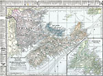
The Maritime Provinces of Canada, 1920
A map from 1920 of the Maritime Provinces of Canada, including New Brunswick, Nova Scotia, and Prince Edward Island. The map shows the county divisions and capitals, the provincial capitals of Fredericton (New Brunswick), Halifax (Nova Scotia), and C...

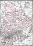
Province of Quebec, 1920
A map from 1920 of the province of Quebec from the St. Lawrence River to Hudson Bay and the Hudson Strait. The map shows the Dominion capital of Ottawa, Province capital of Quebec City, major cities and towns, existing and proposed railways, canals, ...

Quebec Province (South Central Part), 1920
A map from 1920 of the south–central part of the province of Quebec, showing county boundaries and county seats, the Dominion capital of Ottawa, Province capital of Quebec City, major cities, towns, and ports, existing and proposed railways, ca...

Ontario (Southern Part), 1920
A map from 1920 of the southern part of the province of Ontario. The map shows the capital of Ottawa, provincial capital of Toronto, major cities and towns, existing and proposed railways, county boundaries, forest reserve boundaries, national park b...

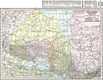
Ontario (Northern Part), 1920
A map from 1920 of the northern part of the province of Ontario. The map shows the capital of Ottawa, major cities and towns, existing and proposed railways, county boundaries, forest reserve boundaries, national park boundaries, Indian reserve bound...

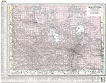
Manitoba (Southern Part), 1920
A map from 1920 of the southern part of the province of Manitoba. The map shows the provincial capital of Winnipeg, major cities and towns, existing and proposed railways, lakes, and rivers of this portion of the province. The grid used by the Domini...

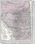
Alberta, 1920
A map from 1920 of the southern part of the province of Alberta. The map shows the provincial capital of Edmonton, major cities and towns, existing and proposed railways, lakes, and rivers of this portion of the province. The grid used by the Dominio...

British Columbia (Southern Part), 1920
A map from 1920 of the southern part of the province of British Columbia. The map shows the provincial capital of Victoria, major cities and towns, existing and proposed railways, National Parks, lakes, and rivers of this portion of the province. The...

First Previous Next Last


  Maps > North America > Canada
Site Map  

Maps ETC is a part of the Educational Technology Clearinghouse
Produced by the Florida Center for Instructional Technology © 2009
College of Education, University of South Florida