| Maps > North America > Complete Maps |
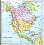 |
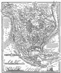
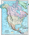
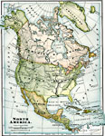
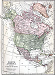
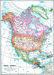
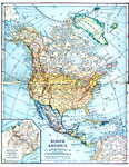
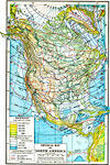
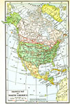
North America, Map of North America. |
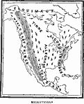 |
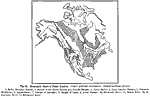
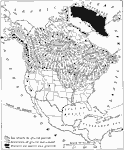
Migrations, An early map showing proposed routes of migration among Native American tribes in North America. |
 |
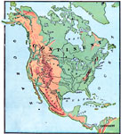
North America (Physical), Map showing physical attributes of various North American countries. |
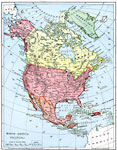 |
North America (Political), Map showing political attributes of various North American countries. |
 |
Development of Colonies and Early Western Explorations, Map to illustrate early discoveries and voyages of North America. |
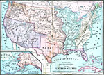 |
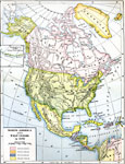
Territorial Development of the United States, Maps to illustrate the territorial development of the United States. |
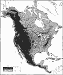 |
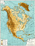
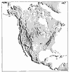
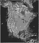
Relief Map of North America, A relief map of North America. |
 |
Mean Average Temperatures in North America, A map showing the mean average temperatures of North America. |
 |
Zoogeographic Areas of North America, A map showing the main zoogeographic areas of North America. |
 |
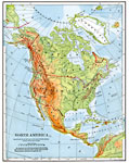
North America (Physical), Map showing physical features of North America. |
 |
Zone Map of North America, A Zone Map of North America. |
 |
Koppen's Classification of Climates, Koppen's classification of climates in relation to vegetation. Tracts enclosed by broken line have distinct dry seasons. |
 |
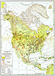
, Untitled map of North America shows population density. |
 |
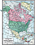
North America, Map of North America. |
 |
People and Subdivisions, Map of United States showing population density. |
 |
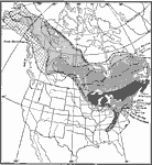
Original Range of the Bison, 1720-1903 A map showing the original range of the bison in North America. Dates of local extermination, location, and numbers of wild heards in 1903. |
 |
North America in 1783, 1783 A map of North America in 1783. |
 |
North American and West Indies in 1870, 1870 A map of North American and the West Indies in 1870. |
 |
North America, 1885 North America, showing major mountain ranges. |
 |
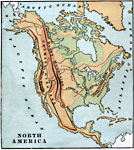
Orographic Chart of North America, 1891 Chart showing the various mountain ranges in North America. |
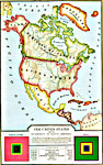 |
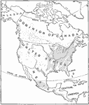
The United States and its Neighbors, 1898 A map showing the United States and its neighbors in North America. |
 |
North America, 1899 Map of North America in color. |
 |
North America, 1899 Map of North America in color. |
 |
, 1899 Map of Forest Regions of North America. |
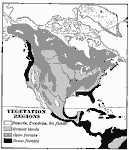 |
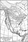
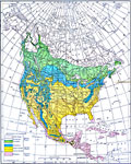
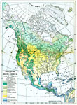
North American Vegetation Regions, 1901 Vegetation regions in North America. |
 |
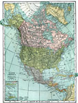
North America, 1901 Map of North America. |
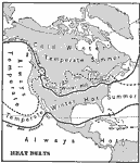 |
North American Heat Belts, 1901 Heat Belts of North America. |
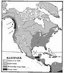 |
North American Rainfall, 1901 Rainfall patterns in North America. |
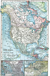 |
North America, 1903 A map of North America, with two close up sections of Central America. |
 |
North America, 1906 Map of North America in 1906. |
 |
North America, 1909 A map of North America from 1913. |
 |
Relief Map of North America, 1909 A relief map of North America. |
 |
North America, 1909 Map of North America. |
 |
North America, 1910 A map of North America. |
 |
Physical map of North America, 1910 A physical map of North America, showing elevation. |
 |
North America, 1910 A relief map of North America. |
 |
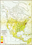
North American Population Density, 1910 A population density map of North America in 1910. |
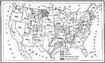 |
Coal and Iron Deposits in the United States, 1910 A map showing the distribution of deposits of coal and iron in the United States around 1910. |
 |
Conifers in Canada and Eastern United States, 1911 A map showing the distribution of the dominent conifers in Canada and eastern United States. |
 |
North America, Post World War I Map of North America. |
 |
North American Ice Sheets, 1916 A map of the North American ice sheets, showing the extent of ice during the glacial period, and the extent of ice sheets in 1916. |
 |
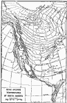
Physical Map of North America, 1916 A map of North America showing elevation of land, depth of ocean water and isothermal lines. |
 |
Economic Map of North America, 1916 A map of North America showing areas of production and non-production, and areas of industry and agriculture. |
 |
Vegetation Map of North America, 1916 A map of North America showing areas of different types of natural vegatation. |
 |
Population Map of North America, 1916 A map of North America showing density of population per square mile and towns with over 100,000 residents. |
 |
Political Map of North America, 1916 A map of North America showing major cities, railroads, and proposed railroads. |
 |
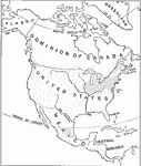
Political Map of North America, 1919 A political map of North and Central America from 1919. |
 |
The Surface of North America, 1920 This map of North America shows the land itself with its streams and mountains. |
 |
North America, 1920 The continent of North America. |
| Maps > North America > Complete Maps |
Maps is a part of the Educational Technology Clearinghouse
Produced by the Florida Center for Instructional Technology © 2007
College of Education, University of South Florida