|
|
|
| Maps > North America > Complete Maps |
Historic and contemporary maps of North America, including physical and political maps, early exploration maps, colonization period, Native American distribution, climate maps, relief maps, population density and distribution maps, vegetation maps, and economic/resource maps.
|
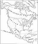
People and Subdivisions,
1897 |
|
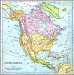
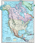
North America,
1897 |
|
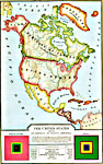
The United States and Neighbors,
1898 |
|
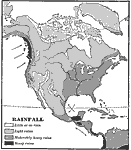
Rainfall in North America,
1898 |
|
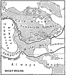
Heat Belts in North America,
1898 |
|
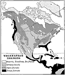
Vegetation Regions,
1898 |
|
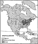
Population of North America,
1898 |
|
North America,
1899 |
|
North America,
1899 |
|
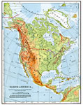
North America,
1901 |
| First | Previous | Next | Last |
| Maps > North America > Complete Maps |
Maps ETC is a part of the Educational Technology Clearinghouse
Produced by the Florida Center for Instructional Technology © 2009
College of Education, University of South Florida