Maps Site map
  Maps > North America > Regional Maps
Site Map  

  Record   51   to   60  of   184

Regional maps of North America, which include several selections of countries and nations displaying physical and political features, economy, discovery, and more.

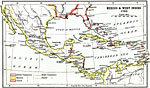
Mexico and West Indies, 1763
A map of Mexico, Central America, and the West Indies showing the foreign territorial possessions established by the Treaty of Paris in 1763. The map is color–coded to show the coastal and island possessions at the time of Spain, Britain, and F...

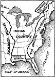
Eastern North America just previous to the Revolution, 1763–1774
British lands in eastern North America just prior to the American Revolution....

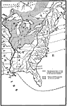
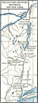
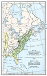
The Country East of the Mississippi During the French-Indian War, 1763–1783
The country east of the Mississippi during the French-Indian War, 1755—1763, color-coded to distinguish various claims to United States....

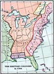
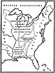
British Colonies after the French and Indian War, 1764
A map of the eastern portion of North America showing the British, Spanish, and Indian territories after the French and Indian War (1754–1763), with the proclamation line as established by the Treaty of Paris (1763). "The newly acquired te...

America at the Time of the Revolution, 1764–1789
A map of eastern North America showing "America at the time of the revolution." — Foster, 1921. This map shows the major divisions and boundaries of the revolutionary time period, including the Spanish Territory west of the Mississip...

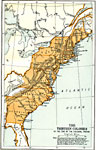
The Thirteen Colonies at the End of the Colonial Period, 1774
A map of the British Thirteen Colonies at the end of the colonial period in 1774. The map shows the boundaries of the colonies and notes the uncolored territory east of the Mississippi and south of the Great Lakes as claimed by Georgia, the Carolinas...

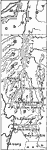
The Country Around Montreal and New York, 1775–1783
The country around Montreal and New York....

Burgoyne's Campaign, 1777
A map of the frontiers of Canada and New York around Lake Champlain showing the Saratoga Campaign of British General John Burgoyne (1777) during the American War of Independence. The map shows Montreal, Canada, Ticonderoga on Lake Champlain, Skenesbo...

Disposition of American Territory proposed by Vergennes, 1781–1782
The division of North American territories as proposed by the French Count of Vergennes....

North America, 1782
A map of eastern North America at the end of the American Revolution, after numerous peace talks were held in Paris between the United States and Britain. This map shows the proposed new boundaries of the United States, English Territory, Spanish Te...

First Previous Next Last


  Maps > North America > Regional Maps
Site Map  

Maps ETC is a part of the Educational Technology Clearinghouse
Produced by the Florida Center for Instructional Technology © 2009
College of Education, University of South Florida