| Maps > Oceania > Regional Maps |
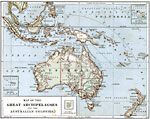 |
Pacific Islands, 1879 The Hawaiian Islands, Samoan Islands, Fiji Islands, and Society Islands. |
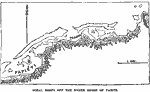 |
Tahiti Coral Reefs, 1885 Coral reefs off the north shore of Tahiti. |
 |
Polynesian Island Chain, 1891 Map showing the Polynesian island chain. |
 |
Pacific Islands, 1903 Maps of Hawaii, Tutuila Island, Samoa, the Phillipines, Wake Island, Howard Island, and Guam. |
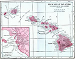 |
Hawaiian Islands (Sandwich Islands), 1906 Map of Hawaiian Islands (Sandwich Islands) in 1906. |
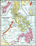 |
Philippine Islands, 1906 Map of Philippine Islands (Sandwich Islands) in 1906. |
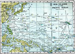 |
Our Islands in the Pacific Ocean, 1909 Our Islands in the Pacific Ocean—Hammond's Handy Atlas of the World, 1911 |
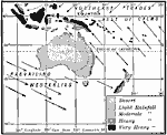 |
Rainfall and Wind in Oceana, 1910 A map showing the heavy rainfall on the east-facing coast of Australia where the trade winds blow. Notice also the arid interior and west coast. |
 |
German Surrenders in Asia and the Pacific, 1919 Germany surrenders all rights in Asia and Asiatic waters. |
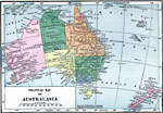 |
Political Map of Australasia, 1919, 1919 A political map of Australasia in 1919. |
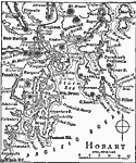 |
Hobart, 1919 A map showing the area around Hobart, the capital of Tasmania. |
| Maps > Oceania > Regional Maps |
Maps is a part of the Educational Technology Clearinghouse
Produced by the Florida Center for Instructional Technology © 2007
College of Education, University of South Florida