|
|
|
| Maps > United States > Civil War |
A collection of historic maps of the American Civil War, including regional seats of the war, battle and campaign maps, and territories held by Confederate and Union forces.

|
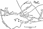
Vicinity of Vicksburg,
May 15, 1863–July 4, 1863 |
|
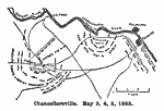
Chancellorsville,
May 1863 |
|
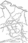
Battle of the Wilderness,
May 1864 |
|
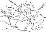
Battle of Spotsylvania,
May 1864 |
|
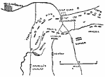
North Anna,
May 1864 |
|
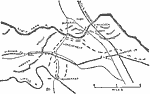
Chancellorsville,
May 2, 1863 |
|
The Battle of Williamsburg,
May 5, 1862 |
|
Mine Run,
November 1863 |

|
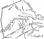
Battle of Chattanooga,
November 1863 |
|
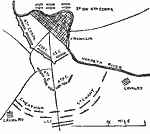
Second Battle of Franklin,
November 30, 1864 |
| First | Previous | Next | Last |
| Maps > United States > Civil War |
Maps ETC is a part of the Educational Technology Clearinghouse
Produced by the Florida Center for Instructional Technology © 2009
College of Education, University of South Florida