Maps Site map
  Maps > United States > Complete Maps
Site Map  

  Record   31   to   40  of   73

Historic and contemporary maps of the United States, including physical and political maps, early exploration and colonization period, territorial expansion maps, climate maps, relief maps, population density and distribution maps, vegetation maps, and economic/resource maps.

The United States, 1901
A map from 1901 of the United States showing physical features of mountain systems and highlands, basins, plains, prairies, limits of the glacial terminal moraines, lakes, rivers, and coastal features. The highlands above 2000 feet are shown in the ...

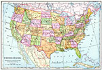
United States, 1901
A map from 1901 of the continental United States showing state boundaries and state capitals, major cities and towns, railroads with connecting lines to the Dominion of Canada and to Mexico, mountain systems, lakes, rivers, and coastal features....

United States Cities and Towns, 1901
A map from 1901 of the contiguous 48 states showing the distribution pattern of the major cities and towns at the time. The larger dots represent the major manufacturing centers and greater population....

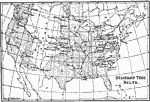
United States Standard Time Belts, 1901
A map from 1901 showing the Standard Time Belts in the contiguous 48 states as they were then established. "The main body of our country is so broad from east to west that more than three hours are required for rotation to carry it past the sun....

United States, 1901
A map from 1901 of the United States showing the physical features of the area, including mountain systems and highlands, plateaus, basins, plains, lakes, rivers, and coastal features. The map is color–coded to show land elevations from sea lev...

Standard Time Belts, 1901
A map from 1901 of the United States showing the time zones as they were then established....

The United States, 1902
A map from 1902 of the United States showing physical features of mountain systems and highlands, basins, plains, prairies, limits of the glacial terminal moraines, lakes, rivers, and coastal features. The highlands above 2000 feet are shown in the ...

Standard Time Belts, 1903
A map from 1903 of the United States showing the time zones as they were then established. "The heavy dotted line shows the arbitrary divisions of time in the United States. The plus and minus marks on either side of the meridian lines show whet...

United States, 1903
A map from 1903 of the continental or ‘lower forty–eight’ United States showing state boundaries and state capitals, major cities and towns, mountain systems, lakes, rivers, and coastal features....

Relief of the United States, 1904
A relief map from 1904 of the United States showing the mountain systems and highlands, plateaus, plains, lakes, rivers, and coastal features. This map divides the area into the main groups of the St. Lawrence Basin, Allegheny Region, New England Hi...

First Previous Next Last


  Maps > United States > Complete Maps
Site Map  

Maps ETC is a part of the Educational Technology Clearinghouse
Produced by the Florida Center for Instructional Technology © 2009
College of Education, University of South Florida