Maps Site map
  Maps > United States > Complete Maps
Site Map  

  Record   51   to   60  of   73

Historic and contemporary maps of the United States, including physical and political maps, early exploration and colonization period, territorial expansion maps, climate maps, relief maps, population density and distribution maps, vegetation maps, and economic/resource maps.

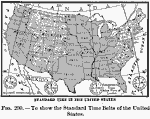
Standard Time in the United States, 1910
A map from 1910 of the United States showing the time zones as they were then established. Clock–symbols at the bottom of the map show the comparative times when it is noon in London. "Formerly every city used its own sun time, or local ti...

Standard Time in the United States, 1910
A map from 1910 of the United States showing the time zones as they were then established. Clock–symbols at the bottom of the map show the comparative times when it is noon in London. "Formerly every city used its own sun time, or local ti...

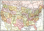
United States, 1910
A map from 1910 of the ‘lower forty–eight’ United States showing state boundaries and state capitals, major cities and towns, railroads, mountain systems, lakes, rivers, and coastal features....

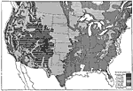
Swamp lands of the United States, 1911
A map from the 19th Annual Report of the U.S. Geological Survey (1898) showing areas of swamp and marsh lands in the United States at the time, with degrees of swampiness shown in two shadings....

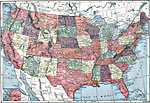
United States, 1912
A map from 1912 of the ‘lower forty–eight’ United States showing state boundaries and state capitals, major cities and towns, mountain systems, lakes, rivers, and coastal features....

The United States, 1913
A map from 1913 of the United States with an inset map of the Alaska Territory. The map shows state boundaries and capitals at the time (for example, the map shows Guthrie as the capital of the Oklahoma Territory), major cities and towns, railroads, ...

Farmer's Mutual Insurance Companies in the United States, 1913
The distribution of farmer's mutual insurance companies in the United States. Small dot = 1 company; large dot = 10 companies....

United States Land Elevations, 1914
A map from 1914 of the United States showing the general land elevations. The map is coded to show area elevations from sea level to above 10,000 feet....

Army Camps in the United States, 1914–1919
A map from 1920 of the United States showing the main U. S. Army camps during World War I (1914–1919)....

Flood Stations, 1916
A map from 1916 of the United States showing the cities where the government maintained flood stations at the time. "Reservoirs to hold back flood waters have been proposed, but their construction would be very expensive. The Weather Bureau keep...

First Previous Next Last


  Maps > United States > Complete Maps
Site Map  

Maps ETC is a part of the Educational Technology Clearinghouse
Produced by the Florida Center for Instructional Technology © 2009
College of Education, University of South Florida