Maps Site map
  Maps > United States > Early America 1400-1800
Site Map  

  Record   121   to   130  of   143

A collection of historic maps of early America from explorations and settlements of the English, French, and Spanish, to the end of the American Revolutionary War.

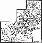
The Revolution in the Middle States, 1776
A map of America's middle states during the time of the American Revolution, including New York, Pennsylvania, New Jersey, Delaware, Maryland, and part of Virginia and North Carolina. The map shows major cities, towns, forts, battle sites, mountain s...

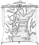
Engagement Between Valcour Island and the Western Shore (Lake Champlain), 1776
A detail map of central Lake Champlain near Plattsburgh showing the Battle of Valcour Island (October 11–13, 1776) between the British and American navies. The map is keyed to show (A) the American fleet under Arnold, (B) 21 gun-boats, (C) scho...

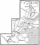
Campaigns in New York and New Jersey, 1776
A map showing the area of the New York and New Jersey campaign (1776) during the American Revolutionary War. The map shows the British landing on Staten Island in June, 1776, the advance across the Narrows to Brooklyn, Washington's retreat to Harlem ...

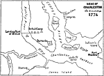
Siege of Charleston, 1776
A sketch map of the Charleston Harbor area showing the first British siege of Charleston in 1776, also known as the Battle of Sullivan's Island (June 28, 1776). The map shows the positions of the British ships, the landing site north of Charleston on...

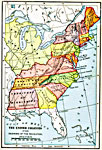
The United Colonies, 1776
A map of the United Colonies at the beginning of the American Revolution (1776) showing colonial land claims to the Mississippi River, including the territories organized after the war. The map shows the Northwest Territory (organized in 1787), Provi...

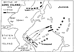
Battle of Long Island, 1776
A plan of the Battle of Long Island (August 27, 1776), also known as the Battle of Brooklyn, fought between the British army under General Howe and the Americans under George Washington during the American Revolutionary War. The map shows the British...

The American Indian Nations, 1776
An early map of the southeastern North America around 1776, showing the American Indian Nations of the region at the time. The map shows colonial boundaries extending from the Atlantic coast to the Mississippi River, towns, forts, and rivers....

The Thirteen Colonies , 1776
A map of the thirteen colonies at the outset of the American Revolutionary War, showing major cities and towns, the Great Lakes, mountains, rivers, and coastline....

Washington's Winter Campaign, 1776–1777
A map of parts of New York, New Jersey, and Pennsylvania showing General Washington's campaign in the winter of 1776—1777....

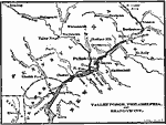
Valley Forge, Philadelphia, and Brandywine, 1776–1778
A map of the area around Valley Forge and Philadelphia (the first capital, 1774–1800), site of several important operations during the American Revolution, including Washington's crossing of the Delaware near Trenton (1776), Wilmington, the Bri...

First Previous Next Last


  Maps > United States > Early America 1400-1800
Site Map  

Maps ETC is a part of the Educational Technology Clearinghouse
Produced by the Florida Center for Instructional Technology © 2009
College of Education, University of South Florida