Maps Site map
  Maps > United States > Early America 1400-1800
Site Map  

  Record   141   to   150  of   199

A collection of historic maps of early America from explorations and settlements of the English, French, and Spanish, to the end of the American Revolutionary War.

Routes of Burgoyne and St. Leger, 1777
A map showing the routes of the British campaigns of Burgoyne and St. Leger in 1777 during the American Revolutionary War. The map shows the route of Burgoyne from Montreal to Lake Champlain, Fort Ticonderoga, Shenesboro, Fort Edward, Bennington, Bem...

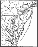
Howe's Route to Philadelphia, 1777
A map of New Jersey, Pennsylvania, Delaware, and Maryland showing the Philadelphia Campaign route(1777) of British commander General William Howe from Long Island to the Chesapeake Bay, his landing site at Elkton (Head of Elk) Maryland, Chadds Ford (...

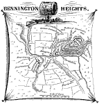
Bennington Heights, 1777
A map of the area around Walloomsac, New York, near Bennington, Vermont, showing the site of the Battle of Bennington Heights (August 16, 1777) between the British under Friedrich Baum and the American militiamen under General John Stark and Colonel ...

Surrender of Burgoyne, 1777
A map of the vicinity of Saratoga, New York, at the time of Burgoyne's surrender (October 17, 1777) to the American forces under General Gates. The map shows the Hudson River and surrounding terrain, roads, farmlands and woodlands, the ruins of Fort ...

Bemis' Heights, 1777
A map of the area around Bemis' Heights along the Hudson River, site of the Second Battle of Saratoga (October 7, 1777). The map shows significant locations in the vicinity around Bemis' Heights, such as the British and the American encampments, Fort...

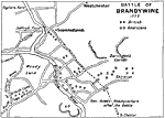
Battle of Brandywine, 1777
A battle plan of the Battle of Brandywine in Pennsylvania south of Philadelphia during the American Revolution (September 11, 1777). The American defeat of this battle allowed the British to capture Philadelphia. The map shows the Brandywine River, t...

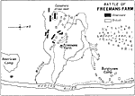
Battle of Freemans Farm, 1777
A plan of the Battle of Freeman's Farm (September 19, 1777), also known as the First Saratoga, fought between the British army under John Burgoyne and the Americans under Horatio Gates and Benedict Arnold during the American Revolutionary War. The ma...

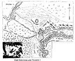
Fort Schuyler and Vicinity, 1777
A map of Fort Schuyler (Fort Stanwix) and vicinity at the southern end of Lake Oneida and Mohawk River, site of the Battle of Oriskany (August 6, 1777). The map shows the events of this battle, and is keyed to show: (A) Fort Schuyler; (b) southwest b...

The Campaigns in the Middle States, 1777–1778
A map of parts of New York, New Jersey, Pennsylvania, and Maryland involved in the early years of the American Revolutionary War. The map shows cities and towns, rivers and terrain, forts, and battle sites of the region, including Crown Point, Ticond...

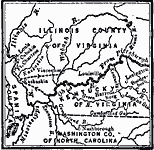
Route of George Rogers Clark, 1777–1779
A map of the Ohio country where in 1778–1779 George Rogers Clark led the Illinois Campaign to capture the British stronghold at Vincennes, marking an end to British power in the west. The map shows Clark's route from Pittsburgh along the Ohio R...

First Previous Next Last


  Maps > United States > Early America 1400-1800
Site Map  

Maps ETC is a part of the Educational Technology Clearinghouse
Produced by the Florida Center for Instructional Technology © 2009
College of Education, University of South Florida