|
|
|
| Maps > United States > Early America 1400-1800 |
A collection of historic maps of early America from explorations and settlements of the English, French, and Spanish, to the end of the American Revolutionary War.

|
Plan of West Point showing Forts and Batteries,
1780 |
|
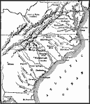
Operations in the South during the American Revolutionary War,
1780–1781 |

|
The War in the South,
1780–1781 |
|
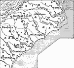
Greene's Campaign in the South,
1781 |
|
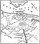
The Siege of Yorktown,
1781 |
|
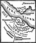
Siege of Yorktown,
1781 |

|
Siege of Yorktown,
1781 |
|
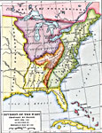
Division of the West,
1782 |
|
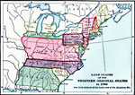
Land Claims of the Colonies,
1783 |
|
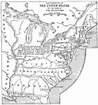
The United States at the Close of the Revolution,
1783 |
| First | Previous | Next | Last |
| Maps > United States > Early America 1400-1800 |
Maps ETC is a part of the Educational Technology Clearinghouse
Produced by the Florida Center for Instructional Technology © 2009
College of Education, University of South Florida